|
search place name
|
||
Al Manşūrīyah (Diyālá, Iraq)Al Manşūrīyah is a town in the Diyālá region of Iraq. An overview map of the region around Al Manşūrīyah is displayed below.
regional and 3d topo map of Al Manşūrīyah, Iraq ::
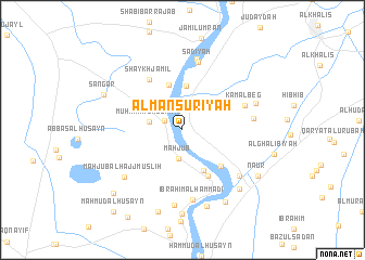
Nearby towns ::
Abāyachi (1.8km north west) //
Maḩjūb (3.0km south) //
Muḩammad al Jamīl (2.9km west) //
Bustān Ḩawījah (4.6km north) //
Aḩmad ‘Alī (4.6km south east) //
Mūsá Ja‘far (4.7km north) //
Muḩammad al Qāsim (5.2km south east) //
As Sayyid Aḩmad (5.0km south east) //
Shaykh Jamīl (5.9km north west) //
Kamāl Beg (5.9km north east) //
Sa‘dīyah (7.1km north) //
Ibrāhīm al Ḩammādī (7.3km south) //
Sab‘ (6.2km east) //
Imām Muḩammad Ibn al Ḩasan (7.4km north) //
Marāsimah (6.8km south east) //
Maḩjūb al Ḩājj Muşliḩ (7.0km south west) //
Ḩusayn al Ḩājjī (7.8km south) //
Jayzānī al Imām (6.8km north east) //
Al Ḩuwaysh (8.2km south) //
Dukhaylā (7.7km south east) //
Qaşīrīn (8.3km south east) //
Yāsīn Abū Ḩamad (8.7km south) //
Maḩmūd al Ḩabīb (8.7km south) //
Sangar (7.6km north west) //
Nā‘ūr (8.0km south east) //
Qaryat ‘Alī al Aḩmad (8.8km south west) //
Ḩusayn ad Durrah (10.3km south west) //
Maḩmūd al Ḩusayn (10.3km south west) //
[all distances 'as the bird flies' and approximate] 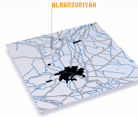 Places with similar names to Al Manşūrīyah, Iraq ::
// Al Manşūrīyah (IQ)
// Al Manşūrīyah (IQ)
// Al Mansūrīyah (IQ)
// Al Manşūrīyah (EG)
// Al Manşūrīyah (EG)
// Al Manşūrīyah (SA)
// Al Manşūrīyah (KW)
// Al Manşūrīyah (LB)
// Al Manşūrīyah (LB)
// Al Manşūrīyah (YE)
Disclaimer :: Information on this page comes without warranty of any kind |
||
|
Where is Al Manşūrīyah? Elevation and coordinates ::
Latitude (lat): 33°45'32"N Longitude (lon): 44°23'49"E
Elevation (approx.): 45m (map arrows pan, magnifying glasses zoom) |
||
|
Visiting Al Manşūrīyah? Hotel/Accommodation ::
Book a hotel in Al Manşūrīyah Travel Guide ::
Buy a travel guide for Iraq rental cars ::
car rental offers GPS waypoint ::
download a GPX waypoint (PoI) of Al Manşūrīyah for your GPS receiver
|
||