|
search place name
|
||
Imām Muḩammad Ibn al Ḩasan (Diyālá, Iraq)Imām Muḩammad Ibn al Ḩasan is a town in the Diyālá region of Iraq. An overview map of the region around Imām Muḩammad Ibn al Ḩasan is displayed below.
regional and 3d topo map of Imām Muḩammad Ibn al Ḩasan, Iraq ::
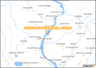
Nearby towns ::
Sa‘dīyah (0.3km south) //
Jamīl ‘Umrān (2.2km north) //
Bustān Ḩawījah (2.9km south) //
Mūsá Ja‘far (3.6km south west) //
Ḩasan aş Şāliḩ (5.1km north) //
Shaykh Jamīl (4.6km south west) //
Ţuwayr (5.0km north west) //
Shabīb ar Rajab (5.6km north west) //
Kamāl Muḩyī (6.2km north) //
Qaryat as Sindīyah (6.5km north east) //
Kamāl Beg (6.3km south east) //
Judaydah (6.2km north east) //
Abāyachi (7.0km south west) //
Al Manşūrīyah (7.4km south) //
Muḩyī (7.3km north) //
Jayzānī al Imām (6.8km south east) //
Muḩammad al Jamīl (7.6km south west) //
Sab‘ (7.8km south east) //
‘Alī Bin Fayyāḑ (8.2km north) //
[all distances 'as the bird flies' and approximate] 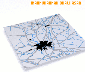 Places with similar names to Imām Muḩammad Ibn al Ḩasan, Iraq :: Disclaimer :: Information on this page comes without warranty of any kind |
||
|
Where is Imām Muḩammad Ibn al Ḩasan? Elevation and coordinates ::
Latitude (lat): 33°49'28"N Longitude (lon): 44°24'38"E
Elevation (approx.): 44m (map arrows pan, magnifying glasses zoom) |
||
|
Visiting Imām Muḩammad Ibn al Ḩasan? Hotel/Accommodation ::
Book a hotel in Imām Muḩammad Ibn al Ḩasan Travel Guide ::
Buy a travel guide for Iraq rental cars ::
car rental offers GPS waypoint ::
download a GPX waypoint (PoI) of Imām Muḩammad Ibn al Ḩasan for your GPS receiver
|
||