|
search place name
|
||
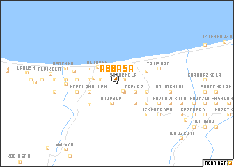
‘Abbāsā (Iran)‘Abbāsā is a town in Iran. An overview map of the region around ‘Abbāsā is displayed below.
regional and 3d topo map of ‘Abbāsā, Iran ::
‘Abbāsā airports ::
The nearest airport is THR - Teheran Mehrabad Intl, located 112.9 km south west of ‘Abbāsā.
Other airports nearby include RZR - Ramsar (123.9 km west), Nearby towns ::
Shahr Kolā (1.0km north east) //
Salyākotī (1.3km south east) //
‘Abbās Kolā (1.6km south east) //
Tashkūh-e Soflá (2.2km west) //
Tīr Kolā (2.2km west) //
Dārjār (2.7km south east) //
Anār Jār (3.2km south) //
Tāshkūh-e ‘Olyā (3.1km west) //
‘Alam Deh (3.5km north west) //
Khūrīyeh (4.0km south east) //
Tīrak Deh-e Soflá (3.6km west) //
Toskā (3.6km west) //
Ḩoseynābād (3.6km west) //
Tāshkūh-e Pā'īn (3.6km west) //
Kord Maḩalleh (3.8km west) //
Gandyāb-e Pā'īn (4.1km east) //
Gandyāb-e Bālā (4.1km east) //
Nūr (4.2km north east) //
Hendū Marz (4.3km north west) //
Kāsehgar Maḩalleh (4.9km south west) //
Zakīābād (5.0km south east) //
Sarkaj (5.0km south east) //
Zarrīn Kolā (5.1km west) //
Nīrak Deh-e Bālā (5.1km west) //
Sīāh Rūd (5.1km west) //
Tīrak Deh-e ‘Olyā (5.1km west) //
Khorramābād (5.3km west) //
Nātel (6.3km south east) //
Tamīshān (5.8km north east) //
[all distances 'as the bird flies' and approximate] 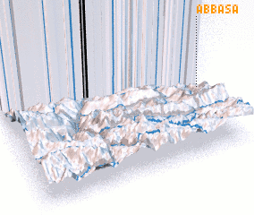 Places with similar names to ‘Abbāsā, Iran ::
Disclaimer :: Information on this page comes without warranty of any kind |
||
|
Where is ‘Abbāsā? Elevation and coordinates ::
Latitude (lat): 36°32'43"N Longitude (lon): 51°59'25"E
Elevation (approx.): -10m (map arrows pan, magnifying glasses zoom) |
||
|
Visiting ‘Abbāsā? Hotel/Accommodation ::
Book a hotel in ‘Abbāsā Travel Guide ::
Buy a travel guide for Iran rental cars ::
car rental offers GPS waypoint ::
download a GPX waypoint (PoI) of ‘Abbāsā for your GPS receiver
|
||