|
search place name
|
||
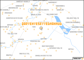
Qaryeh-ye Seyyed Maḩmūd (Khūzestān, Iran)Qaryeh-ye Seyyed Maḩmūd is a town in the Khūzestān region of Iran. An overview map of the region around Qaryeh-ye Seyyed Maḩmūd is displayed below.
regional and 3d topo map of Qaryeh-ye Seyyed Maḩmūd, Iran ::
Qaryeh-ye Seyyed Maḩmūd airports ::
The nearest airport is MRX - Bandar Mahshahr Mahshahr, located 44.9 km south west of Qaryeh-ye Seyyed Maḩmūd.
Other airports nearby include AWZ - Ahwaz (84.8 km north west), QMJ - Masjed Soleiman Shahid Asyaee (127.6 km north), ABD - Abadan (129.9 km south west), BSR - Basrah Intl (175.6 km west), Nearby towns ::
Roẕvān (1.2km south) //
Moţbek-e ‘Abd ol ‘Alī (1.6km south west) //
Moţbek-e ‘Akāshī (1.6km south west) //
Moţbek-e Chāseb (1.7km south) //
Sarāvīn-e Bālā (2.1km north) //
Sarāvīn-e Pā'īn (2.4km north) //
Dehīlī (2.4km east) //
Moţbek-e ‘Abdollāh (2.7km south west) //
Laḩmer-e ‘Olyā (3.4km south) //
Yerī (3.1km west) //
Hathida (4.2km north) //
Mozebleh-ye Soflá (4.6km north east) //
Sayyāḩ (5.2km south) //
Abū Shenān-e Pā'īn (5.1km north) //
Ţabreh-ye Bālā (5.4km south) //
Laḩmer-e Soflá (5.3km south east) //
Abū ‘Oleymeh (6.1km north) //
Mesheylshīyeh-ye ‘Olyā (5.6km west) //
Mesheylshīyeh-ye Pā'īn (5.6km west) //
Rāmshīr (5.9km north west) //
‘Edd-e Sovādī (6.6km south) //
Mīshelshīyeh-ye Soflá (6.3km west) //
Omm ol Ţarafeh-ye Soflá (7.2km north east) //
‘Agleh Bachāy (7.2km north east) //
Amīr ol Mo'menīn (7.0km north west) //
Abū Shenān-e Bālā (7.9km north) //
Omm oţ Ţarfeh-ye Vosţá (7.9km north) //
Āzādeh (7.6km south west) //
AbūFolūs (8.1km south) //
[all distances 'as the bird flies' and approximate] 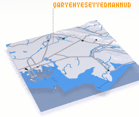 Places with similar names to Qaryeh-ye Seyyed Maḩmūd, Iran :: Disclaimer :: Information on this page comes without warranty of any kind |
||
|
Where is Qaryeh-ye Seyyed Maḩmūd? Elevation and coordinates ::
Latitude (lat): 30°51'46"N Longitude (lon): 49°27'31"E
Elevation (approx.): 25m (map arrows pan, magnifying glasses zoom) |
||
|
Visiting Qaryeh-ye Seyyed Maḩmūd? Hotel/Accommodation ::
Book a hotel in Qaryeh-ye Seyyed Maḩmūd Travel Guide ::
Buy a travel guide for Iran rental cars ::
car rental offers GPS waypoint ::
download a GPX waypoint (PoI) of Qaryeh-ye Seyyed Maḩmūd for your GPS receiver
|
||