|
search place name
|
||
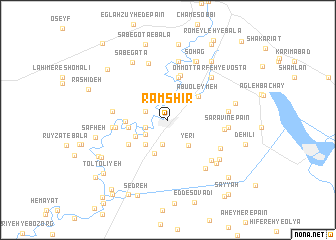
Rāmshīr (Khūzestān, Iran)Rāmshīr is a town in the Khūzestān region of Iran. An overview map of the region around Rāmshīr is displayed below.
regional and 3d topo map of Rāmshīr, Iran ::
Rāmshīr airports ::
The nearest airport is MRX - Bandar Mahshahr Mahshahr, located 44.4 km south west of Rāmshīr.
Other airports nearby include AWZ - Ahwaz (78.9 km north west), QMJ - Masjed Soleiman Shahid Asyaee (123.9 km north), ABD - Abadan (126.8 km south west), BSR - Basrah Intl (171.3 km west), Nearby towns ::
Amīr ol Mo'menīn (1.1km north west) //
Abū Ţoveyj (2.4km north) //
Belād Moţlab-e Seyyed Yerī (2.3km west) //
Belād Moţlab-e Seyyed Yaḩyá (2.4km north west) //
Belād Moţlab-e Seyyed Jāsem (2.4km north west) //
Mesheylshīyeh-ye ‘Olyā (2.8km south) //
Mesheylshīyeh-ye Pā'īn (2.8km south) //
Boneh-ye Seyyed Khalaf (2.9km north) //
Belād Moţlab-e Seyyed Fākher (2.9km north) //
Sen (2.7km south west) //
Yerī (3.5km south east) //
Emāmzādeh Oveys-e Qarnī (3.5km south west) //
Mīshelshīyeh-ye Soflá (3.9km south) //
Nowshādī (3.6km south west) //
Abū ‘Oleymeh (3.9km north east) //
Seyyed Yaḩyá (3.8km west) //
Mostowfīābād (3.8km west) //
Belād Moţlab-e Seyyed Mosallam (4.0km west) //
Ḩoseynīyeh-ye Sheneyen (4.8km north) //
Ḩoseynīyeh-ye Kheẕayer (4.8km north) //
Ḩoseynīyeh-ye Chāseb (5.1km north) //
Sayes (4.6km south west) //
Kher Fereḩ-e Bālā (5.1km west) //
Būkhāmeh-ye Bālā (5.4km west) //
Kharfereh-ye Yakom (5.4km west) //
Sarāvīn-e Bālā (5.5km east) //
‘Alīol Hādī (6.6km north) //
Ḩoseynīyeh-ye Mashkūr (6.6km north) //
Qaryeh-ye Seyyed Maḩmūd (5.9km south east) //
[all distances 'as the bird flies' and approximate] 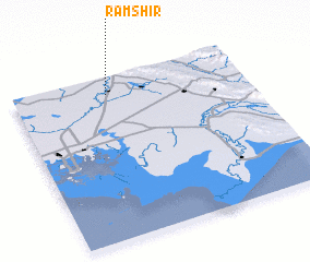 Places with similar names to Rāmshīr, Iran ::
Disclaimer :: Information on this page comes without warranty of any kind |
||
|
Where is Rāmshīr? Elevation and coordinates ::
Latitude (lat): 30°53'28"N Longitude (lon): 49°24'21"E
Elevation (approx.): 26m (map arrows pan, magnifying glasses zoom) |
||
|
Visiting Rāmshīr? Hotel/Accommodation ::
Book a hotel in Rāmshīr Travel Guide ::
Buy a travel guide for Iran rental cars ::
car rental offers GPS waypoint ::
download a GPX waypoint (PoI) of Rāmshīr for your GPS receiver
|
||