|
search place name
|
||
Shāh Hormoz (Kermān, Iran)Shāh Hormoz is a town in the Kermān region of Iran. An overview map of the region around Shāh Hormoz is displayed below.
regional and 3d topo map of Shāh Hormoz, Iran ::

Shāh Hormoz airports ::
The nearest airport is KER - Kerman, located 70.8 km south east of Shāh Hormoz.
Nearby towns ::
Deh Aqā'ī (2.8km south east) //
Ābpangū'īyeh (2.8km south east) //
Banestān (3.0km east) //
Gazūyeh (5.2km south east) //
Gīsk (6.0km north west) //
Deh Aḩmad (6.1km south east) //
Gezū'īyeh (6.6km south east) //
Akbarābād (6.6km south east) //
Band Borjī (7.9km north) //
Būtūyeh (8.0km north) //
Zarand (7.6km south west) //
Ḩoseynābād (8.1km south west) //
Bābgohar (8.0km north east) //
Ebrāhīmābād (9.0km south west) //
Reyḩān (8.2km south west) //
Zarandū'īyeh (8.4km south west) //
Bāb Tangal (8.9km north west) //
Bandū (8.6km north east) //
Dar Tangal-e Qadamgāh (9.2km north west) //
Gatkū'īyeh (8.9km south east) //
Akbarābād (8.8km south west) //
Bābsīfān (9.8km north east) //
Bābcheryūn (9.8km north east) //
[all distances 'as the bird flies' and approximate] 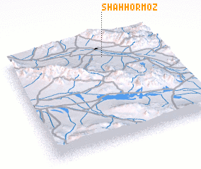 Places with similar names to Shāh Hormoz, Iran ::
// Shirimsâḥ (EG)
// Chermoz (RU)
// Charmīz (IR)
// Char Meāsa (BD)
// Char Rames (BD)
// Char Ramiz (BD)
// Shurumsay (KZ)
// Chiramussua (MZ)
// Chirimazi (MZ)
// Chermisey (FR)
Disclaimer :: Information on this page comes without warranty of any kind |
||
|
Where is Shāh Hormoz? Elevation and coordinates ::
Latitude (lat): 30°51'1"N Longitude (lon): 56°37'57"E
Elevation (approx.): 1911m (map arrows pan, magnifying glasses zoom) |
||
|
Visiting Shāh Hormoz? Hotel/Accommodation ::
Book a hotel in Shāh Hormoz Travel Guide ::
Buy a travel guide for Iran rental cars ::
car rental offers GPS waypoint ::
download a GPX waypoint (PoI) of Shāh Hormoz for your GPS receiver
|
||