|
search place name
|
||
Shādi Khel (Federally Administered Tribal Areas, Pakistan)Shādi Khel is a town in the Federally Administered Tribal Areas region of Pakistan. An overview map of the region around Shādi Khel is displayed below.
regional and 3d topo map of Shādi Khel, Pakistan ::

Shādi Khel airports ::
The nearest airport is JAA - Jalalabad, located 135.5 km north of Shādi Khel.
Other airports nearby include PEW - Peshawar Intl (139.3 km north east), KBL - Kabul Intl (187.0 km north west), PZH - Zhob (219.6 km south west), SDT - Saidu Sharif (257.5 km north east), Nearby towns ::
Babalāi (1.0km east) //
Āba Khel (1.1km north east) //
Fateh Khel (1.2km north west) //
Spīnwām (1.2km east) //
Babalāi (1.4km south east) //
Khīr Khel (1.5km north east) //
Muhammad Jān Kili (2.0km north west) //
Dreplari (2.3km north west) //
Kot Mīr Akbar (2.6km north west) //
Khar Sina (4.4km south west) //
Fateh Khel (5.6km north) //
Kot Shakain (6.1km north west) //
Datta Khel (6.6km south east) //
Kot Faqīr Hasan (6.4km north west) //
Datta Khel (6.8km south east) //
Kot Ghulām Jān (6.8km north west) //
Dreplare (8.1km north west) //
Srakata (7.1km east) //
Dardoni (8.1km north west) //
Datta Khel (8.8km south east) //
[all distances 'as the bird flies' and approximate] 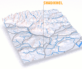 Places with similar names to Shādi Khel, Pakistan ::
// Shād Khāl (IR)
// Chewdai Khullah (PK)
// Chitta Khel (PK)
// Shādi Khel (PK)
// Shādi Khel (PK)
// Shādi Khel (PK)
// Shādu Khel (PK)
// Shāti Khel (PK)
// Shātu Khel (PK)
// Shitkhala (RU)
Disclaimer :: Information on this page comes without warranty of any kind |
||
|
Where is Shādi Khel? Elevation and coordinates ::
Latitude (lat): 33°10'59"N Longitude (lon): 70°22'6"E
Elevation (approx.): 744m (map arrows pan, magnifying glasses zoom) |
||
|
Visiting Shādi Khel? Hotel/Accommodation ::
Book a hotel in Shādi Khel Travel Guide ::
Buy a travel guide for Pakistan rental cars ::
car rental offers GPS waypoint ::
download a GPX waypoint (PoI) of Shādi Khel for your GPS receiver
|
||