|
search place name
|
||
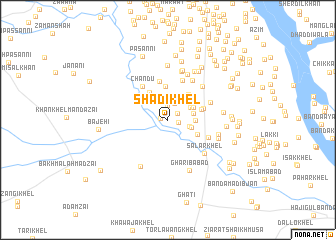
Shādi Khel (North-West Frontier, Pakistan)Shādi Khel is a town in the North-West Frontier region of Pakistan. An overview map of the region around Shādi Khel is displayed below.
regional and 3d topo map of Shādi Khel, Pakistan ::
Shādi Khel airports ::
The nearest airport is PEW - Peshawar Intl, located 159.6 km north east of Shādi Khel.
Other airports nearby include JAA - Jalalabad (188.4 km north), PZH - Zhob (192.2 km south west), KBL - Kabul Intl (249.3 km north west), Nearby towns ::
Bahāwal Khān (0.7km west) //
Sāleh Khān (1.0km east) //
Shekh Hassan (1.2km north east) //
Islām Nagar (1.6km north) //
Dre Plāra (1.9km north) //
Chuāral (2.3km north) //
Gidar Bānda (2.2km east) //
Jangi Khān (2.5km north west) //
Tofān Khān Bānda (2.3km east) //
Kotka Akbar Zamān (2.5km north east) //
Harāma Talla (2.5km east) //
Ashraf Mozhāna (2.8km north east) //
Hāji Muno Bānda (2.6km east) //
Kotka Gul Howz (2.8km north east) //
Kotka Mangthira (3.4km north east) //
Sorāb Bānda (3.2km south east) //
Bānda Sarmast Khan (3.7km north) //
Kot Kashmīr (3.6km north west) //
Pāinda Michan Khel (3.4km east) //
Pāinda (3.4km east) //
Mamin Michan Khel (3.6km east) //
Kāzim Khān (4.4km north) //
Chandu (4.4km north west) //
Naurang Khān (4.6km north) //
Tājāzai (4.3km south east) //
Kotka Jāfar Khān (4.4km north east) //
Amīn Jabu Khel (5.0km north east) //
Gandi Khān Khel (4.9km north east) //
Salār Khel (5.1km south east) //
[all distances 'as the bird flies' and approximate] 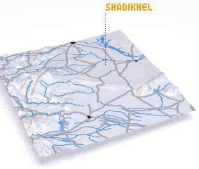 Places with similar names to Shādi Khel, Pakistan ::
// Shād Khāl (IR)
// Chewdai Khullah (PK)
// Chitta Khel (PK)
// Shādi Khel (PK)
// Shādi Khel (PK)
// Shādu Khel (PK)
// Shāti Khel (PK)
// Shātu Khel (PK)
// Shādi Khel (PK)
// Shitkhala (RU)
Disclaimer :: Information on this page comes without warranty of any kind |
||
|
Where is Shādi Khel? Elevation and coordinates ::
Latitude (lat): 32°42'46"N Longitude (lon): 70°43'58"E
Elevation (approx.): 281m (map arrows pan, magnifying glasses zoom) |
||
|
Visiting Shādi Khel? Hotel/Accommodation ::
Book a hotel in Shādi Khel Travel Guide ::
Buy a travel guide for Pakistan rental cars ::
car rental offers GPS waypoint ::
download a GPX waypoint (PoI) of Shādi Khel for your GPS receiver
|
||