|
search place name
|
||
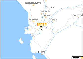
Santa (Ancash, Peru)Santa is a town in the Ancash region of Peru. An overview map of the region around Santa is displayed below.
regional and 3d topo map of Santa, Peru ::
Santa airports ::
The nearest airport is CHM - Chimbote Teniente Jaime A De Montreuil Morales, located 20.2 km south east of Santa.
Other airports nearby include TRU - Trujillo Capitan Carlos Martinez De Pinillos (114.4 km north west), ATA - Anta Comandante Fap German Arias Graziani (117.2 km east), JJI - Juanjui (287.8 km north east), Nearby towns ::
San Dionisio (1.9km north) //
La Huaca (1.8km west) //
Tambo Real (2.6km north east) //
Cambio Puente (3.7km east) //
Santa Clara (5.2km north west) //
Coishco (5.2km south west) //
El Porvenir (5.5km west) //
El Castillo (5.9km north) //
La Mora (6.6km north east) //
El Gallinazo (7.4km north) //
San Eusebio (7.6km north) //
[all distances 'as the bird flies' and approximate] 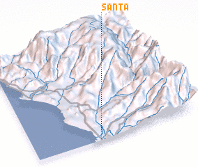 Places with similar names to Santa, Peru ::
Disclaimer :: Information on this page comes without warranty of any kind |
||
|
Where is Santa? Elevation and coordinates ::
Latitude (lat): 8°59'0"S Longitude (lon): 78°36'0"W
Elevation (approx.): 37m (map arrows pan, magnifying glasses zoom) |
||
|
Visiting Santa? Hotel/Accommodation ::
Book a hotel in Santa Travel Guide ::
Buy a travel guide for Peru rental cars ::
car rental offers GPS waypoint ::
download a GPX waypoint (PoI) of Santa for your GPS receiver
|
||