|
search place name
|
||
Cerro Azul (Barinas, Venezuela)Cerro Azul is a town in the Barinas region of Venezuela. An overview map of the region around Cerro Azul is displayed below.
regional and 3d topo map of Cerro Azul, Venezuela ::

Cerro Azul airports ::
The nearest airport is BNS - Barinas, located 32.5 km south east of Cerro Azul.
Other airports nearby include VLV - Valera Dr Antonio Nicolas Briceno (57.2 km north), GUQ - Guanare (71.6 km east), MRD - Merida Alberto Carnevalli (90.9 km west), AGV - Acarigua Oswaldo Guevara Mujica (147.4 km north east), Nearby towns ::
La Ardita (2.2km west) //
Agua Dulce (2.7km south west) //
Villa Coromoto (3.0km north west) //
Las Tunas (4.9km north) //
San José (5.6km south west) //
Guaito (6.3km north west) //
Palo Grande (6.4km south) //
Palmarito (6.4km north west) //
La Honda (6.4km west) //
Las Mulatas (7.3km south) //
Peña Morada de Calderitas (7.3km east) //
Sacapan (7.4km north) //
Los Bucares (7.6km south west) //
Piedra de Moler (8.0km north west) //
La Cuchilla (8.1km north west) //
La Honda (8.2km north west) //
El Cumbe (8.6km south west) //
Calderas (8.7km north west) //
El Guafal (8.7km west) //
La Laguna (8.8km north) //
El Pueblito (8.8km south) //
La Pedregosa (8.8km south west) //
Los Naranjos (8.9km west) //
La Sabana (9.0km north west) //
Los Naranjitos (9.2km north west) //
Las Lajitas (9.4km north west) //
Las Margaritas (9.5km north west) //
Cruz Verde (10.0km north west) //
Las Flores (10.3km north west) //
[all distances 'as the bird flies' and approximate] 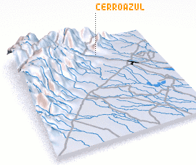 Places with similar names to Cerro Azul, Venezuela ::
// Şorsulu (AZ)
// Şorsulu (AZ)
// Xoruzlu (AZ)
// Zarıslı (AZ)
// Sarcillo (US)
// Cerrezuela (PA)
// Cerro Azul (PA)
// Cerro Azul (PA)
// Cerasola (IT)
// Cerasolo (IT)
Disclaimer :: Information on this page comes without warranty of any kind |
||
|
Where is Cerro Azul? Elevation and coordinates ::
Latitude (lat): 8°51'48"N Longitude (lon): 70°23'6"W
Elevation (approx.): 1702m (map arrows pan, magnifying glasses zoom) |
||
|
Visiting Cerro Azul? Hotel/Accommodation ::
Book a hotel in Cerro Azul Travel Guide ::
Buy a travel guide for Venezuela rental cars ::
car rental offers GPS waypoint ::
download a GPX waypoint (PoI) of Cerro Azul for your GPS receiver
|
||