|
search place name
|
||
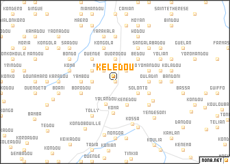
Kélédou (Kissidougou, Guinea)Kélédou is a town in the Kissidougou region of Guinea. An overview map of the region around Kélédou is displayed below.
regional and 3d topo map of Kélédou, Guinea ::
Kélédou airports ::
The nearest airport is FAA - Faranah, located 134.6 km north west of Kélédou.
Nearby towns ::
Oualto (0.0km north) //
Bando (0.0km north) //
Mafendou (2.6km north west) //
Pobenguo (2.6km north east) //
Ouorodou (3.7km north) //
Koukongo (3.7km west) //
Yalandou (3.9km south) //
Kongola (4.1km north west) //
Solonto (4.1km south east) //
Kenédou (4.2km south east) //
Kôma (5.1km south) //
Badangba (5.2km north east) //
Bédou (5.2km north east) //
Ouendé (5.2km north west) //
Korondou (5.2km north west) //
Léla (5.5km east) //
Ouladin (5.5km east) //
Yambou (5.5km west) //
Yomandou (5.8km east) //
Damba (5.8km east) //
Borodou (5.8km west) //
Kongola (5.9km north) //
Kingué (6.7km north east) //
Tolly (6.7km south west) //
Saguebé (6.7km south west) //
Bendou (6.6km south east) //
Koma (6.8km south east) //
Kossa (7.4km south) //
Dembadou (7.4km north) //
[all distances 'as the bird flies' and approximate] 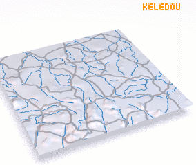 Places with similar names to Kélédou, Guinea ::
Disclaimer :: Information on this page comes without warranty of any kind |
||
|
Where is Kélédou? Elevation and coordinates ::
Latitude (lat): 9°1'0"N Longitude (lon): 10°6'0"W
Elevation (approx.): 644m (map arrows pan, magnifying glasses zoom) |
||
|
Visiting Kélédou? Hotel/Accommodation ::
Book a hotel in Kélédou Travel Guide ::
Buy a travel guide for Guinea rental cars ::
car rental offers GPS waypoint ::
download a GPX waypoint (PoI) of Kélédou for your GPS receiver
|
||