|
search place name
|
||
Kamabara (Byumba, Rwanda)Kamabara is a town in the Byumba region of Rwanda. An overview map of the region around Kamabara is displayed below.
regional and 3d topo map of Kamabara, Rwanda ::

Kamabara airports ::
The nearest airport is KGL - Kigali Intl, located 40.3 km south of Kamabara.
Other airports nearby include GYI - Gisenyi (108.6 km west), GOM - Goma (110.9 km west), KME - Kamembe (174.6 km south west), BKY - Bukavu/kavumu Bukavu Kavumu (176.0 km south west), Nearby towns ::
Mwenya (2.6km south west) //
Kiterwe (2.6km south east) //
Nyabichwamba (2.6km north east) //
Muti (3.7km west) //
Mugera (3.7km east) //
Gatsibo (4.7km north) //
Neke (5.9km north) //
Nyarubungu (5.9km north) //
Gituza (5.9km east) //
Nyagitabire (6.7km south west) //
Gishikiri (6.7km north west) //
Murambi (7.4km north) //
Ngarama (8.1km north) //
Rugogwe (9.3km south east) //
Bwisige (9.8km north west) //
[all distances 'as the bird flies' and approximate] 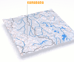 Places with similar names to Kamabara, Rwanda ::
// Camíbar (CR)
// Camíbar (CR)
// Kiamabara (KE)
// Comibar (MX)
// Koma Béri (NE)
// Gambi Bera (PK)
// Cumbibirá (PE)
// Kamabu-ri (KP)
// Kombobari (PG)
// Kawm Abū Rayyah (EG)
Disclaimer :: Information on this page comes without warranty of any kind |
||
|
Where is Kamabara? Elevation and coordinates ::
Latitude (lat): 1°37'0"S Longitude (lon): 30°14'0"E
Elevation (approx.): 1642m (map arrows pan, magnifying glasses zoom) |
||
|
Visiting Kamabara? Hotel/Accommodation ::
Book a hotel in Kamabara Travel Guide ::
Buy a travel guide for Rwanda rental cars ::
car rental offers GPS waypoint ::
download a GPX waypoint (PoI) of Kamabara for your GPS receiver
|
||