|
search place name
|
||
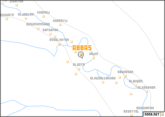
‘Abbās (Dayr az Zawr, Syria)‘Abbās is a town in the Dayr az Zawr region of Syria. An overview map of the region around ‘Abbās is displayed below.
regional and 3d topo map of ‘Abbās, Syria ::
‘Abbās airports ::
The nearest airport is DEZ - Deire Zor Deir Zzor, located 87.8 km north west of ‘Abbās.
Nearby towns ::
Al Khurayţah (2.0km north west) //
Hajīn (2.1km east) //
Al Qaţ‘ā (2.5km south) //
Mazra‘at Shammū (2.9km west) //
Al Quţ‘ah (3.8km south) //
Al Baḩrah (4.3km north west) //
Aş Şāliḩīyah (5.5km north west) //
Al Musallakhah (6.7km south east) //
‘Ajarjah (7.2km north west) //
Şafşāfah (8.2km north west) //
Kharāyij (8.9km north west) //
Ar Ramādī (8.3km south east) //
Al Burham (8.2km south east) //
[all distances 'as the bird flies' and approximate] 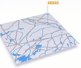 Places with similar names to ‘Abbās, Syria ::
Disclaimer :: Information on this page comes without warranty of any kind |
||
|
Where is ‘Abbās? Elevation and coordinates ::
Latitude (lat): 34°41'19"N Longitude (lon): 40°48'26"E
Elevation (approx.): 180m (map arrows pan, magnifying glasses zoom) |
||
|
Visiting ‘Abbās? Hotel/Accommodation ::
Book a hotel in ‘Abbās Travel Guide ::
Buy a travel guide for Syria rental cars ::
car rental offers GPS waypoint ::
download a GPX waypoint (PoI) of ‘Abbās for your GPS receiver
|
||