|
search place name
|
||
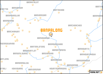
Ban Palông (Phôngsali, Laos)Ban Palông is a town in the Phôngsali region of Laos. An overview map of the region around Ban Palông is displayed below.
regional and 3d topo map of Ban Palông, Laos ::
Ban Palông airports ::
The nearest airport is LPQ - Luang Prabang Luang Phabang Intl, located 160.9 km south of Ban Palông.
Nearby towns ::
Ban Houanga (3.0km south west) //
Ban Poungkhao (3.7km south) //
Ban Houay-Oun (5.4km south) //
Ban Ômtanéng (6.1km south east) //
Ban Tanlôtong (6.5km south west) //
Ban Vangmai (7.0km south) //
Ban Houayvang (7.4km south) //
Ban Chomchèo-Kao (7.0km east) //
Ban Talèo (7.5km north west) //
Ban Kangsan (7.9km north west) //
Ban Phouteup (7.8km west) //
Ban Vangsout (8.3km south) //
Ban Xaoyè (8.3km north west) //
Ban Chomchèo (8.6km east) //
Ban Takhao (9.2km north) //
Ban Phialo-Mai (8.8km north west) //
Ban Houaylot (9.5km south west) //
[all distances 'as the bird flies' and approximate] 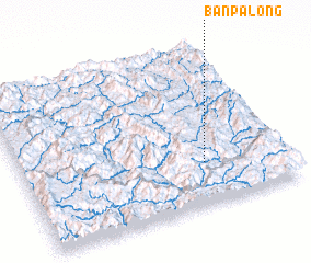 Places with similar names to Ban Palông, Laos ::
// Ban Na Plang (TH)
// Ban Pae Luang (TH)
// Ban Plaeng (TH)
// Ban Pleng (TH)
// Ban Pling (TH)
// Ban Pling (TH)
// Buna Palang (IN)
// Ban Paléng (LA)
// Ban Paliang (LA)
// Ban Palong (LA)
Disclaimer :: Information on this page comes without warranty of any kind |
||
|
Where is Ban Palông? Elevation and coordinates ::
Latitude (lat): 21°15'41"N Longitude (lon): 102°41'43"E
Elevation (approx.): 726m (map arrows pan, magnifying glasses zoom) |
||
|
Visiting Ban Palông? Hotel/Accommodation ::
Book a hotel in Ban Palông Travel Guide ::
Buy a travel guide for Laos rental cars ::
car rental offers GPS waypoint ::
download a GPX waypoint (PoI) of Ban Palông for your GPS receiver
|
||