|
search place name
|
||
Ban Pleng (Maha Sarakham, Thailand)Ban Pleng is a town in the Maha Sarakham region of Thailand. An overview map of the region around Ban Pleng is displayed below.
regional and 3d topo map of Ban Pleng, Thailand ::

Ban Pleng airports ::
The nearest airport is NAK - Nakhon Ratchasima Khorat, located 127.7 km south west of Ban Pleng.
Other airports nearby include UTH - Udon Thani (199.7 km north), SNO - Sakon Nakhon (210.2 km north east), ZVK - Savannakhet (211.3 km north east), LOE - Loei (248.0 km north west), Nearby towns ::
Ban Khok Luan (1.9km south) //
Ban Daeng Noi (2.6km south west) //
Ban Khok Chan Hom (5.1km south east) //
Ban Sadao Wan (7.4km north) //
Ban Waeng (7.4km west) //
Phutthaisong (8.2km south west) //
Ban Mek Dam (9.1km south east) //
Ban Toei (9.1km south west) //
Ban Nong Paen (9.1km north east) //
Ban Don Klang (9.0km north west) //
Ban Don (10.3km north west) //
[all distances 'as the bird flies' and approximate] 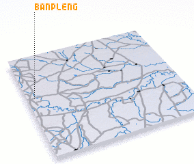 Places with similar names to Ban Pleng, Thailand ::
// Ban Na Plang (TH)
// Ban Pae Luang (TH)
// Ban Plaeng (TH)
// Ban Pling (TH)
// Ban Pling (TH)
// Buna Palang (IN)
// Ban Paléng (LA)
// Ban Paliang (LA)
// Ban Palong (LA)
// Ban Palông (LA)
Disclaimer :: Information on this page comes without warranty of any kind |
||
|
Where is Ban Pleng? Elevation and coordinates ::
Latitude (lat): 15°36'0"N Longitude (lon): 103°3'0"E
Elevation (approx.): 143m (map arrows pan, magnifying glasses zoom) |
||
|
Visiting Ban Pleng? Hotel/Accommodation ::
Book a hotel in Ban Pleng Travel Guide ::
Buy a travel guide for Thailand rental cars ::
car rental offers GPS waypoint ::
download a GPX waypoint (PoI) of Ban Pleng for your GPS receiver
|
||