|
search place name
|
||
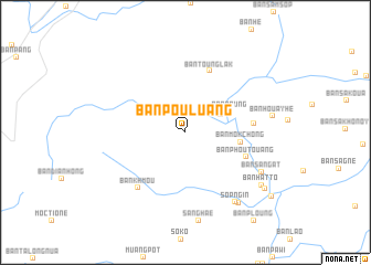
Ban Pouluang (Louangnamtha, Laos)Ban Pouluang is a town in the Louangnamtha region of Laos. An overview map of the region around Ban Pouluang is displayed below.
regional and 3d topo map of Ban Pouluang, Laos ::
Ban Pouluang airports ::
The nearest airport is LPQ - Luang Prabang Luang Phabang Intl, located 121.1 km south east of Ban Pouluang.
Other airports nearby include THL - Tachilek Tachileik (153.5 km west), KET - Kengtung (193.4 km west), Nearby towns ::
Ban Hatnalèng (3.8km north east) //
Ban Poung (4.7km north east) //
Ban Môkchông (5.3km east) //
Ban Phoutouang (6.2km south east) //
Ban Tounglak (6.6km north) //
Ban Chang-On (6.5km east) //
Ban Khmou (7.2km south west) //
Sop Ngin (8.5km south east) //
Ban Sang-At (8.3km south east) //
Ban Houayphay (2) (8.7km south east) //
Ban Houayhè (8.4km east) //
Ban Hatto (8.9km south east) //
Ban Houayphay (1) (9.4km south east) //
Ban Hatchala (10.4km south east) //
[all distances 'as the bird flies' and approximate] 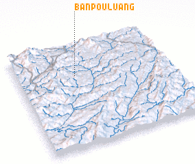 Places with similar names to Ban Pouluang, Laos ::
// Ban Na Plang (TH)
// Ban Pae Luang (TH)
// Ban Plaeng (TH)
// Ban Pleng (TH)
// Ban Pling (TH)
// Ban Pling (TH)
// Buna Palang (IN)
// Ban Paléng (LA)
// Ban Paliang (LA)
// Ban Palong (LA)
Disclaimer :: Information on this page comes without warranty of any kind |
||
|
Where is Ban Pouluang? Elevation and coordinates ::
Latitude (lat): 20°42'49"N Longitude (lon): 101°23'16"E
Elevation (approx.): 583m (map arrows pan, magnifying glasses zoom) |
||
|
Visiting Ban Pouluang? Hotel/Accommodation ::
Book a hotel in Ban Pouluang Travel Guide ::
Buy a travel guide for Laos rental cars ::
car rental offers GPS waypoint ::
download a GPX waypoint (PoI) of Ban Pouluang for your GPS receiver
|
||