|
search place name
|
||
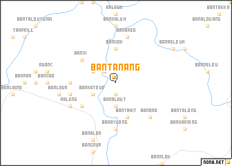
Ban Tanang (Laos)Ban Tanang is a town in Laos. An overview map of the region around Ban Tanang is displayed below.
regional and 3d topo map of Ban Tanang, Laos ::
Ban Tanang airports ::
The nearest airport is DAD - Danang Intl, located 122.3 km east of Ban Tanang.
Other airports nearby include PKZ - Pakse (162.0 km south west), Nearby towns ::
Ban Avôn (1.9km south) //
Ban Krachan (2.6km north west) //
Ban Alout (3.7km south) //
Ban Katrup (4.0km south west) //
Ban Amouan (4.0km north west) //
Ban Kôk (5.6km north) //
Ban Tahit (5.8km south) //
Ban Xi (6.5km north west) //
Ban Alôt (6.5km south west) //
Ban Tamprin (7.1km west) //
Ban Ayuang (7.4km south) //
Ban Aréo (7.6km north) //
Ban Apé (7.4km west) //
Ban Anô (7.7km south east) //
Pa Leng (8.0km south west) //
[all distances 'as the bird flies' and approximate]  Places with similar names to Ban Tanang, Laos ::
// Ban Don Ong (TH)
// Ban Tan Noeng (TH)
// Ban Dong Hong (LA)
// Ban Dong Hong (LA)
// Ban Tanang (LA)
// Ban Tannôn (2) (LA)
// Ban Tanong (LA)
// Ban Tanông (LA)
// Bindanang (CM)
// Bản Ðông Hương (VN)
Disclaimer :: Information on this page comes without warranty of any kind |
||
|
Where is Ban Tanang? Elevation and coordinates ::
Latitude (lat): 15°54'0"N Longitude (lon): 107°4'0"E
Elevation (approx.): 885m (map arrows pan, magnifying glasses zoom) |
||
|
Visiting Ban Tanang? Hotel/Accommodation ::
Book a hotel in Ban Tanang Travel Guide ::
Buy a travel guide for Laos rental cars ::
car rental offers GPS waypoint ::
download a GPX waypoint (PoI) of Ban Tanang for your GPS receiver
|
||