|
search place name
|
||
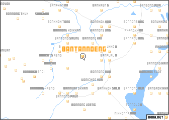
Ban Tan Noeng (Sakon Nakhon, Thailand)Ban Tan Noeng is a town in the Sakon Nakhon region of Thailand. An overview map of the region around Ban Tan Noeng is displayed below.
regional and 3d topo map of Ban Tan Noeng, Thailand ::
Ban Tan Noeng airports ::
The nearest airport is SNO - Sakon Nakhon, located 55.5 km east of Ban Tan Noeng.
Other airports nearby include UTH - Udon Thani (88.2 km west), VTE - Vientiane Wattay Intl (133.2 km north west), ZVK - Savannakhet (149.0 km south east), LOE - Loei (201.7 km west), Nearby towns ::
Ban Nong Lak Chang (2.6km north west) //
Ban Phang Ho (3.5km east) //
Ban Don Ya Nang (4.0km north east) //
Ban Dong Mi Chai (4.0km south west) //
Ban Nong Wai (4.1km north east) //
Ban Waeng (4.0km north west) //
Ban Pha Khao (4.0km north west) //
Ban Nong Bua (5.1km south east) //
Ban Nong Saeng (5.1km north west) //
Ban Pla Lo (5.3km east) //
Warichaphum (5.8km south) //
Amphoe Phang Khon (5.6km east) //
Ban Khok Suwan (5.6km west) //
Ban Lao (5.6km west) //
Ban Na Muang (5.6km east) //
Ban Um Mao (5.6km east) //
Ban Hai (6.5km south east) //
Ban Non Sung (6.6km north east) //
Ban Nong Hoi Khan (6.6km north west) //
Ban Kut Saeng (7.1km west) //
Ban Huai Bang (7.6km south) //
Ban Muang Khan (7.6km south) //
Ban Kho (7.3km west) //
Ban Don Yao Noi (7.3km west) //
Amphoe Waritchaphum (8.2km south west) //
Ban Pha Khao (8.2km north east) //
Ban Kham Bit (9.1km south west) //
Ban Khok Sala (9.1km south east) //
Ban Kham Ta Na (9.1km north west) //
[all distances 'as the bird flies' and approximate] 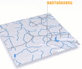 Places with similar names to Ban Tan Noeng, Thailand ::
// Ban Don Ong (TH)
// Ban Dong Hong (LA)
// Ban Dong Hong (LA)
// Ban Tanang (LA)
// Ban Tanang (LA)
// Ban Tannôn (2) (LA)
// Ban Tanong (LA)
// Ban Tanông (LA)
// Bindanang (CM)
// Bản Ðông Hương (VN)
Disclaimer :: Information on this page comes without warranty of any kind |
||
|
Where is Ban Tan Noeng? Elevation and coordinates ::
Latitude (lat): 17°20'0"N Longitude (lon): 103°37'0"E
Elevation (approx.): 176m (map arrows pan, magnifying glasses zoom) |
||
|
Visiting Ban Tan Noeng? Hotel/Accommodation ::
Book a hotel in Ban Tan Noeng Travel Guide ::
Buy a travel guide for Thailand rental cars ::
car rental offers GPS waypoint ::
download a GPX waypoint (PoI) of Ban Tan Noeng for your GPS receiver
|
||