|
search place name
|
||
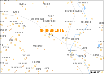
Manabalate (Inhambane, Mozambique)Manabalate is a town in the Inhambane region of Mozambique. An overview map of the region around Manabalate is displayed below.
regional and 3d topo map of Manabalate, Mozambique ::
Manabalate airports ::
The nearest airport is VNX - Vilankulu Vilankulo, located 31.4 km south east of Manabalate.
Nearby towns ::
Tiano (1.1km west) //
Semende (1.2km north) //
Bacela (1.2km south east) //
Fafetine (2.4km west) //
Janane (2.9km north west) //
Fadecuane (3.9km south east) //
Maela (4.2km north) //
Mueoane (4.2km north west) //
Malangute (4.6km east) //
Mudarroupa (5.0km north) //
Faife (5.0km south west) //
Castigo (4.9km east) //
Faquir Jiva (5.0km north east) //
Taime (6.6km north) //
Tchouche (6.4km south west) //
Uaque (6.7km north east) //
Cabo Manusse (7.4km north west) //
Espanela (7.6km north east) //
Sechene (7.9km east) //
Sòzinho (8.3km east) //
Siquisse (8.9km south east) //
Manuel (9.7km south east) //
Chefe Maimelane (11.2km north east) //
Chefe Pambarra (11.2km south east) //
[all distances 'as the bird flies' and approximate] 
Disclaimer :: Information on this page comes without warranty of any kind |
||
|
Where is Manabalate? Elevation and coordinates ::
Latitude (lat): 21°52'35"S Longitude (lon): 35°3'1"E
Elevation (approx.): 40m (map arrows pan, magnifying glasses zoom) |
||
|
Visiting Manabalate? Hotel/Accommodation ::
Book a hotel in Manabalate Travel Guide ::
Buy a travel guide for Mozambique rental cars ::
car rental offers GPS waypoint ::
download a GPX waypoint (PoI) of Manabalate for your GPS receiver
|
||