|
search place name
|
||
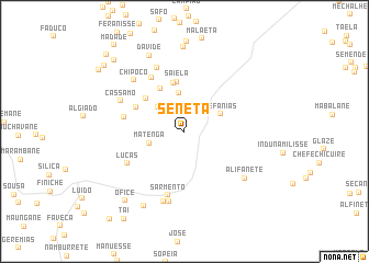
Seneta (Inhambane, Mozambique)Seneta is a town in the Inhambane region of Mozambique. An overview map of the region around Seneta is displayed below.
regional and 3d topo map of Seneta, Mozambique ::
Seneta airports ::
The nearest airport is VNX - Vilankulu Vilankulo, located 91.3 km south east of Seneta.
Other airports nearby include BEW - Beira (184.5 km north), Nearby towns ::
Mapombene (3.5km north west) //
Matenga (3.5km west) //
Machungo (4.0km north) //
Zefanias (3.8km north east) //
Mussequene (4.9km north west) //
Saineta (5.0km north) //
Saiela (5.1km north) //
Régulo Luido (5.0km north west) //
Zefanias (5.2km north west) //
Nhaguiua (5.9km west) //
Tonela (6.3km north west) //
Lucas (6.3km south west) //
Sarmento (6.7km south) //
Chavane (7.0km north) //
Cassamo (6.8km north west) //
Chipoco (7.1km north west) //
Sainda (7.4km south) //
Singarril (7.4km south) //
Alifanete (7.4km south east) //
Davide (8.4km north west) //
Titosse (8.6km north) //
Maguezane (8.5km south west) //
Ofice (9.0km south west) //
Langue (9.8km north west) //
Changabeza (10.2km north west) //
Laita (10.3km north west) //
Vele (10.7km north west) //
Madade (11.0km north west) //
[all distances 'as the bird flies' and approximate] 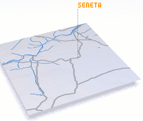 Places with similar names to Seneta, Mozambique ::
Disclaimer :: Information on this page comes without warranty of any kind |
||
|
Where is Seneta? Elevation and coordinates ::
Latitude (lat): 21°26'55"S Longitude (lon): 34°40'30"E
Elevation (approx.): 116m (map arrows pan, magnifying glasses zoom) |
||
|
Visiting Seneta? Hotel/Accommodation ::
Book a hotel in Seneta Travel Guide ::
Buy a travel guide for Mozambique rental cars ::
car rental offers GPS waypoint ::
download a GPX waypoint (PoI) of Seneta for your GPS receiver
|
||