|
search place name
|
||
Gariire (Bay, Somalia)Gariire is a town in the Bay region of Somalia. An overview map of the region around Gariire is displayed below.
regional and 3d topo map of Gariire, Somalia ::

Nearby towns ::
Danaaley (0.0km north) //
Wafdhey Weyn (1.9km east) //
Rooble (1.9km north) //
Jameeco Aaminey (1.9km west) //
Hoogey (2.6km north east) //
Galgalow (3.7km east) //
Dudumiya (3.7km south) //
Buulo Amiin (3.7km south) //
Raaydaboo (4.1km south east) //
Macaruufa (4.1km south east) //
Raarka (4.1km north west) //
Golay (4.1km south west) //
Fuud Saqaar (5.2km south east) //
Shan Hagar (5.6km east) //
Balaaw (5.6km east) //
Miski Roon (5.6km north) //
Galoole Xasanaw Danyeer (5.6km north) //
Galgalow (5.9km east) //
Qaranka (5.9km east) //
Gadiisey (5.9km north) //
Bamburaale (5.9km south) //
Idaaloow (5.9km south) //
Farta (5.9km west) //
Kiyaan (5.9km east) //
Dacarre Yarey (5.9km south) //
Shiidlow (5.9km west) //
Guudka (6.7km north east) //
Qaranka (6.7km north east) //
Buulaal (6.7km south east) //
[all distances 'as the bird flies' and approximate] 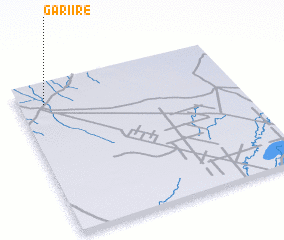 Places with similar names to Gariire, Somalia ::
Disclaimer :: Information on this page comes without warranty of any kind |
||
|
Where is Gariire? Elevation and coordinates ::
Latitude (lat): 2°52'0"N Longitude (lon): 44°7'0"E
Elevation (approx.): 203m (map arrows pan, magnifying glasses zoom) |
||
|
Visiting Gariire? Hotel/Accommodation ::
Book a hotel in Gariire Travel Guide ::
Buy a travel guide for Somalia rental cars ::
car rental offers GPS waypoint ::
download a GPX waypoint (PoI) of Gariire for your GPS receiver
|
||