|
search place name
|
||
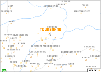
Toumbakro (Cote d'Ivoire)Toumbakro is a town in Cote d'Ivoire. An overview map of the region around Toumbakro is displayed below.
regional and 3d topo map of Toumbakro, Cote d'Ivoire ::
Toumbakro airports ::
The nearest airport is BYK - Bouake, located 21.5 km south west of Toumbakro.
Other airports nearby include ASK - Yamoussoukro (116.5 km south west), HGO - Korhogo (183.0 km north), DJO - Daloa (208.1 km south west), Nearby towns ::
Koundounou (1.7km east) //
Kouadiokro (1.8km south west) //
Amanékro (2.6km north) //
Mblakro (3.4km south west) //
Konan Nguessankra (3.5km west) //
Sokoro (3.5km south west) //
Afoumvasso (4.5km west) //
Ndoua-Kouamékro (4.6km south) //
Akouadoukro (5.4km south) //
Adiékankro (7.0km south west) //
Diongonou (8.3km south) //
Yoboékouadiokro (8.3km south west) //
Borobo (8.8km south west) //
Langbasso (9.2km south east) //
Prikro (10.6km south west) //
[all distances 'as the bird flies' and approximate] 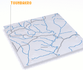 Places with similar names to Toumbakro, Cote d'Ivoire ::
// Tomaicuri (BO)
// Tumagari (RU)
// Demakar (IQ)
// Timmukuru (EE)
// Dāmgāra (BD)
// Dāmgāra (BD)
// Dāmgāria (BD)
// Demākuri (BD)
// Tammboukirou (BJ)
// Diémoukourou (BF)
Disclaimer :: Information on this page comes without warranty of any kind |
||
|
Where is Toumbakro? Elevation and coordinates ::
Latitude (lat): 7°51'30"N Longitude (lon): 4°55'11"W
Elevation (approx.): 250m (map arrows pan, magnifying glasses zoom) |
||
|
Visiting Toumbakro? Hotel/Accommodation ::
Book a hotel in Toumbakro Travel Guide ::
rental cars ::
car rental offers GPS waypoint ::
download a GPX waypoint (PoI) of Toumbakro for your GPS receiver
|
||