|
search place name
|
||
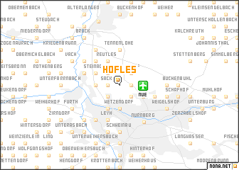
Höfles (Bayern, Germany)Höfles is a town in the Bayern region of Germany. An overview map of the region around Höfles is displayed below.
regional and 3d topo map of Höfles, Germany ::
Höfles airports ::
The nearest airport is NUE - Nuernberg Nurnberg, located 2.4 km east of Höfles.
Other airports nearby include BYU - Bayreuth (69.3 km north east), GHF - Giebelstadt Aaf (78.9 km west), HOQ - Hof Plauen (105.7 km north east), AGB - Augsburg (119.8 km south), Nearby towns ::
Sack (1.2km west) //
Braunsbach (1.2km west) //
Buch (1.2km east) //
Poppenreuth (2.2km south west) //
Boxdorf (2.2km north west) //
Kraftshof (2.2km north east) //
Neunhof (2.2km north east) //
Schnepfenreuth (2.2km south east) //
Bislohe (2.4km west) //
Muggenhof (3.7km south) //
Wetzendorf (3.7km south) //
Schniegling (3.7km south) //
Allmoshof (2.4km east) //
Doos (3.9km south) //
Reutles (3.9km north) //
Steinach (3.0km north west) //
Thon (3.0km south east) //
Kleinreuth hinter der Veste (3.0km south east) //
Großgründlach (4.4km north west) //
Kleingründlach (4.4km north west) //
Tennenlohe (5.6km north) //
Höfen (5.7km south) //
Leyh (5.7km south) //
Gaismannshof (5.7km south) //
Großreuth hinter der Veste (4.1km south east) //
Marienberg (4.1km south east) //
Lohe (4.1km south east) //
Stadeln (4.1km north west) //
Herboldshof (4.1km north west) //
[all distances 'as the bird flies' and approximate] 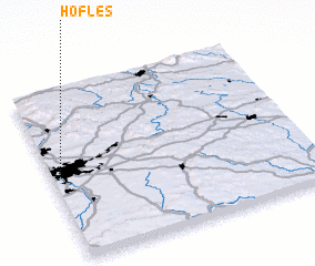 Places with similar names to Höfles, Germany ::
Disclaimer :: Information on this page comes without warranty of any kind |
||
|
Where is Höfles? Elevation and coordinates ::
Latitude (lat): 49°30'0"N Longitude (lon): 11°2'0"E
Elevation (approx.): 305m (map arrows pan, magnifying glasses zoom) |
||
|
Visiting Höfles? Hotel/Accommodation ::
Book a hotel in Höfles Travel Guide ::
Buy a travel guide for Germany rental cars ::
car rental offers GPS waypoint ::
download a GPX waypoint (PoI) of Höfles for your GPS receiver
|
||