|
search place name
|
||
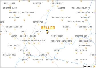
Bellon (Poitou-Charentes, France)Bellon is a town in the Poitou-Charentes region of France. An overview map of the region around Bellon is displayed below.
regional and 3d topo map of Bellon, France ::
Bellon airports ::
The nearest airport is ANG - Angouleme Brie Champniers, located 48.4 km north of Bellon.
Other airports nearby include CNG - Cognac Chateaubernard (52.3 km north west), PGX - Perigueux Bassillac (56.0 km east), EGC - Bergerac Roumaniere (61.5 km south east), BOD - Bordeaux Merignac (83.9 km south west), Nearby towns ::
Courlac (2.6km west) //
Saint-Romain (3.2km south east) //
Rouffiac (4.5km south west) //
Montboyer (4.5km north west) //
Orival (4.3km south west) //
Aubeterre-sur-Dronne (5.4km south east) //
Saint-Quentin-de-Chalais (5.4km south west) //
Les Essards (7.4km south) //
Laprade (5.5km east) //
Pillac (5.5km east) //
Sainte-Marie (5.5km west) //
Bors-de-Montmoreau (6.8km north east) //
Saint-Christophe (6.4km south west) //
Bonnes (7.9km south) //
Saint-Avit (9.1km south west) //
Saint-Martial (9.1km north west) //
[all distances 'as the bird flies' and approximate] 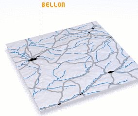 Places with similar names to Bellon, France ::
Disclaimer :: Information on this page comes without warranty of any kind |
||
|
Where is Bellon? Elevation and coordinates ::
Latitude (lat): 45°18'0"N Longitude (lon): 0°7'0"W
Elevation (approx.): 105m (map arrows pan, magnifying glasses zoom) |
||
|
Visiting Bellon? Hotel/Accommodation ::
Book a hotel in Bellon Travel Guide ::
Buy a travel guide for France rental cars ::
car rental offers GPS waypoint ::
download a GPX waypoint (PoI) of Bellon for your GPS receiver
|
||