|
search place name
|
||
Caudan (Bretagne, France)Caudan is a town in the Bretagne region of France. An overview map of the region around Caudan is displayed below.
regional and 3d topo map of Caudan, France ::

Caudan airports ::
The nearest airport is LRT - Lorient Lann Bihoue, located 10.1 km south west of Caudan.
Other airports nearby include VNE - Vannes Meucon (47.2 km east), UIP - Quimper Pluguffan (64.8 km west), SBK - St.-brieuc Armor Armor (87.7 km north east), MXN - Morlaix Ploujean (94.5 km north), Nearby towns ::
Lainmat (1.2km west) //
Grand Moustoir (2.2km north east) //
Kerbébon (2.2km south west) //
Saint-Nudec (3.7km south east) //
Kermen (4.2km south east) //
Le Ruzo (4.9km south east) //
Saint-Caradec (4.0km east) //
Calan (5.7km north) //
Hennebont (4.2km south east) //
Ty-Mor (4.4km south east) //
Kermorvan (5.8km south) //
Le Resto (5.1km south east) //
Le Petit Resto (5.2km south east) //
Belann (5.9km south) //
Pen-Mané (6.2km south) //
Le Plessis (6.4km south) //
Le Mané (5.9km south east) //
Les Chantiers (6.6km south) //
Kerhono (6.5km south) //
Toul-Bahado (6.5km south) //
Locunel (6.7km south) //
Talhouët (6.1km south east) //
Cléguer (5.3km north west) //
Saint-Guénaël (6.5km south) //
Tréfaven (6.1km south west) //
Kerduale (6.1km south west) //
Kervégant (5.3km south west) //
Le Resto (5.3km south east) //
Haut-Locoyarn (5.1km south east) //
[all distances 'as the bird flies' and approximate] 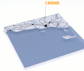 Places with similar names to Caudan, France ::
Disclaimer :: Information on this page comes without warranty of any kind |
||
|
Where is Caudan? Elevation and coordinates ::
Latitude (lat): 47°49'0"N Longitude (lon): 3°20'0"W
Elevation (approx.): 38m (map arrows pan, magnifying glasses zoom) |
||
|
Visiting Caudan? Hotel/Accommodation ::
Book a hotel in Caudan Travel Guide ::
Buy a travel guide for France rental cars ::
car rental offers GPS waypoint ::
download a GPX waypoint (PoI) of Caudan for your GPS receiver
|
||