|
search place name
|
||
Châteaubourg (Rhône-Alpes, France)Châteaubourg is a town in the Rhône-Alpes region of France. An overview map of the region around Châteaubourg is displayed below.
regional and 3d topo map of Châteaubourg, France ::

Châteaubourg airports ::
The nearest airport is VAF - Valence Chabeuil, located 12.9 km south east of Châteaubourg.
Other airports nearby include GNB - Grenoble Saint Geoirs (55.2 km north east), OBS - Aubenas-vals-lanas Ardeche Meridionale (63.2 km south west), EBU - St.-etienne Boutheon (74.1 km north west), LYN - Lyon Bron (81.2 km north), Nearby towns ::
La Roche-de-Glun (0.0km north) //
Les Combeaux (2.3km south east) //
Glun (2.3km north west) //
Gouyard (2.6km west) //
Pont-de-lʼIsère (2.6km east) //
La Rage (3.7km north) //
Saint-Georges (3.7km north) //
Cornas (3.7km south) //
Mauves (3.9km north) //
La Peyrarce (4.5km north west) //
Combes (3.9km west) //
Beauséjour (3.9km east) //
Saint-Péray (5.7km south) //
Saint-Romain-de-Lerps (4.3km south west) //
Bourg-lès-Valence (6.1km south east) //
Conflans (6.1km north east) //
Tain-lʼHermitage (7.4km north) //
La Mule-Blanche (7.4km north) //
Tournon (7.5km north) //
Granges-lès-Valence (7.5km south) //
Guilherand (7.5km south) //
Plats (5.6km west) //
Les Chevaliers (5.6km west) //
Beaumont-Monteux (5.6km east) //
Les Fourniers (6.8km south west) //
Pommare (6.4km south west) //
Les Odouards (8.4km north east) //
Mercurol (8.4km north east) //
Valence (8.4km south east) //
[all distances 'as the bird flies' and approximate] 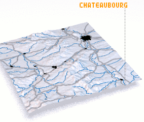 Places with similar names to Châteaubourg, France ::
// Shady Brook (US)
// Shadowbrook (US)
// Chāt Bārīk (IR)
// Shady Brook (US)
// Shady Brook (US)
// Shady Brook (US)
// Shadow Brook (US)
// Shadowbrook (US)
// Châteaubourg (FR)
// Shady Brook (US)
Disclaimer :: Information on this page comes without warranty of any kind |
||
|
Where is Châteaubourg? Elevation and coordinates ::
Latitude (lat): 45°0'0"N Longitude (lon): 4°51'0"E
Elevation (approx.): 112m (map arrows pan, magnifying glasses zoom) |
||
|
Visiting Châteaubourg? Hotel/Accommodation ::
Book a hotel in Châteaubourg Travel Guide ::
Buy a travel guide for France rental cars ::
car rental offers GPS waypoint ::
download a GPX waypoint (PoI) of Châteaubourg for your GPS receiver
|
||