|
search place name
|
||
Châteaubourg (Bretagne, France)Châteaubourg is a town in the Bretagne region of France. An overview map of the region around Châteaubourg is displayed below.
regional and 3d topo map of Châteaubourg, France ::

Châteaubourg airports ::
The nearest airport is RNS - Rennes St Jacques, located 25.5 km west of Châteaubourg.
Other airports nearby include LVA - Laval Entrammes (49.9 km east), DNR - Dinard Pleurtuit (72.7 km north west), SNR - St.-nazaire Montoir (105.6 km south west), VNE - Vannes Meucon (107.8 km south west), Nearby towns ::
Saint-Melaine (1.2km east) //
Broons-sur-Vilaine (2.2km north west) //
La Menillère (2.2km south east) //
Beauvais (2.5km west) //
Saint-Jean-sur-Vilaine (2.5km east) //
Saint-Didier (3.1km south east) //
La Haie-Fonteng (3.1km south west) //
Domagné (3.9km south) //
Le Chalonge (3.9km south) //
La Baudière (4.5km south east) //
Cérisay (4.5km south west) //
Les Crannes (4.5km south west) //
Servon-sur-Vilaine (3.7km west) //
La Bilongére (4.1km north west) //
La Ceuillerai (5.7km north) //
Touche Ronde (5.7km north) //
La Painière (4.1km south east) //
Les Deroteries (5.7km south) //
Le Frêne (5.7km south) //
La Valette (6.1km south east) //
Le Plessix (6.1km south west) //
La Beslinière (5.2km south east) //
La Fredeussais (7.4km north) //
Marpiré (5.3km east) //
Les Chenais (6.7km south east) //
Gralotais (6.7km south west) //
Dourdain (7.8km north) //
La Bouexière (7.8km north) //
Bellevue (7.8km north) //
[all distances 'as the bird flies' and approximate] 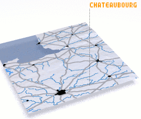 Places with similar names to Châteaubourg, France ::
// Shady Brook (US)
// Shadowbrook (US)
// Chāt Bārīk (IR)
// Shady Brook (US)
// Shady Brook (US)
// Shady Brook (US)
// Shadow Brook (US)
// Shadowbrook (US)
// Châteaubourg (FR)
// Shady Brook (US)
Disclaimer :: Information on this page comes without warranty of any kind |
||
|
Where is Châteaubourg? Elevation and coordinates ::
Latitude (lat): 48°7'0"N Longitude (lon): 1°24'0"W
Elevation (approx.): 67m (map arrows pan, magnifying glasses zoom) |
||
|
Visiting Châteaubourg? Hotel/Accommodation ::
Book a hotel in Châteaubourg Travel Guide ::
Buy a travel guide for France rental cars ::
car rental offers GPS waypoint ::
download a GPX waypoint (PoI) of Châteaubourg for your GPS receiver
|
||