|
search place name
|
||
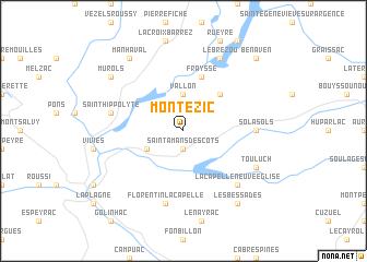
Montézic (Midi-Pyrénées, France)Montézic is a town in the Midi-Pyrénées region of France. An overview map of the region around Montézic is displayed below.
regional and 3d topo map of Montézic, France ::
Montézic airports ::
The nearest airport is AUR - Aurillac, located 27.9 km north west of Montézic.
Other airports nearby include RDZ - Rodez Marcillac (35.1 km south), MEN - Mende Brenoux (73.5 km east), LBI - Albi Le Sequestre (97.3 km south west), LPY - Le Puy Loudes (97.6 km north east), Nearby towns ::
Saint-Amans-des-Cots (1.9km south) //
Vallon (3.7km north) //
Campouriez (3.2km south west) //
Saint-Gervais (4.5km north east) //
Fraysse (5.7km north) //
Solasols (5.3km east) //
Saint-Hippolyte (5.6km west) //
Florentin-la-Capelle (7.5km south) //
La Capelle-Neuve-Église (6.8km south east) //
Le Brézou (7.9km north) //
Bars (7.9km north) //
Touluch (6.4km south east) //
Murols (7.7km north west) //
Manhaval (8.4km north west) //
Les Bessades (8.4km south east) //
Bénaven (9.1km north east) //
[all distances 'as the bird flies' and approximate]  Places with similar names to Montézic, France ::
// Mandasig (PH)
// Mantscha (AT)
// Muntscha (DE)
// Montasico (IT)
// Monte Seco (PT)
// Manotskiy (RU)
// Mandazaka (MG)
// Mondzoku (CD)
// Mandzoko (CG)
// Mindzoukou (CG)
Disclaimer :: Information on this page comes without warranty of any kind |
||
|
Where is Montézic? Elevation and coordinates ::
Latitude (lat): 44°42'0"N Longitude (lon): 2°39'0"E
Elevation (approx.): 704m (map arrows pan, magnifying glasses zoom) |
||
|
Visiting Montézic? Hotel/Accommodation ::
Book a hotel in Montézic Travel Guide ::
Buy a travel guide for France rental cars ::
car rental offers GPS waypoint ::
download a GPX waypoint (PoI) of Montézic for your GPS receiver
|
||