|
search place name
|
||
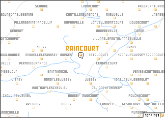
Raincourt (Franche-Comté, France)Raincourt is a town in the Franche-Comté region of France. An overview map of the region around Raincourt is displayed below.
regional and 3d topo map of Raincourt, France ::
Raincourt airports ::
The nearest airport is EPL - Epinal Mirecourt, located 52.8 km north of Raincourt.
Other airports nearby include DIJ - Dijon Longvic (89.3 km south west), ENC - Nancy Essey (95.3 km north), DLE - Dole Tavaux (98.2 km south), CMR - Colmar Houssen (113.4 km east), Nearby towns ::
Blondefontaine (2.2km north west) //
Barges (2.5km west) //
Bétaucourt (2.5km east) //
Cemboing (4.5km south west) //
Cendrecourt (4.2km south east) //
Jussey (5.7km south) //
Villars-le-Pautel (5.3km north east) //
Saint-Marcel (5.3km south west) //
Enfonvelle (7.5km north) //
Aisey-et-Richecourt (5.3km east) //
Bourbévelle (6.7km north east) //
Noroy-lès-Jussey (6.7km south west) //
Jonvelle (7.8km north) //
Fresnes-sur-Apance (8.3km north west) //
Gevigney-et-Mercey (8.3km south east) //
Montcourt (8.9km north east) //
Montigny-lès-Cherlieu (8.9km south west) //
[all distances 'as the bird flies' and approximate] 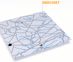 Places with similar names to Raincourt, France ::
// Rinkerode (DE)
// Ríonegrito (ES)
// Renaucourt (FR)
// Riencourt (FR)
// Roncourt (FR)
// Rancourt (FR)
// Rancourt (FR)
// Rengård (SE)
// Rainecourt (FR)
// Roncourt (FR)
Disclaimer :: Information on this page comes without warranty of any kind |
||
|
Where is Raincourt? Elevation and coordinates ::
Latitude (lat): 47°52'0"N Longitude (lon): 5°53'0"E
Elevation (approx.): 260m (map arrows pan, magnifying glasses zoom) |
||
|
Visiting Raincourt? Hotel/Accommodation ::
Book a hotel in Raincourt Travel Guide ::
Buy a travel guide for France rental cars ::
car rental offers GPS waypoint ::
download a GPX waypoint (PoI) of Raincourt for your GPS receiver
|
||