|
search place name
|
||
Herbet (Luxembourg, Belgium)Herbet is a town in the Luxembourg region of Belgium. An overview map of the region around Herbet is displayed below.
regional and 3d topo map of Herbet, Belgium ::

Herbet airports ::
The nearest airport is LGG - Liege, located 28.5 km north of Herbet.
Other airports nearby include MST - Maastricht (61.8 km north), GKE - Geilenkirchen (74.8 km north east), CRL - Charleroi Brussels South (74.8 km west), BRU - Brussels Natl (Melsbroek) (92.1 km north west), Nearby towns ::
Tohogne (1.2km west) //
Le Rote (2.2km south east) //
Houmart (2.2km north west) //
Verlaine (2.2km north east) //
Petit Barvaux (3.7km south) //
Bomal (2.4km east) //
Coquaimont (2.4km west) //
Heidela (3.7km north) //
Juzaine (3.0km south east) //
Warre (3.0km south west) //
Barvaux (3.9km south) //
Loheré (3.9km south) //
Lassus (3.9km north) //
Hermanne (3.9km north) //
La Batte (4.4km south east) //
Durbuy (4.4km south west) //
Tour (4.4km south east) //
Famenne (4.4km south west) //
Himbe (4.4km north west) //
Vesin (5.6km south) //
Longueville (3.5km west) //
Quemanne dʼAtrin (3.5km west) //
Dolmen (5.7km south) //
Vieuxville (4.0km north east) //
Aisne (5.1km south east) //
Weris (6.0km south east) //
Morville (6.0km south east) //
Mignées (6.0km south west) //
Xhignesse (6.0km north east) //
[all distances 'as the bird flies' and approximate] 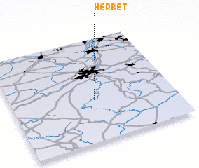 Places with similar names to Herbet, Belgium ::
Disclaimer :: Information on this page comes without warranty of any kind |
||
|
Where is Herbet? Elevation and coordinates ::
Latitude (lat): 50°23'0"N Longitude (lon): 5°30'0"E
Elevation (approx.): 259m (map arrows pan, magnifying glasses zoom) |
||
|
Visiting Herbet? Hotel/Accommodation ::
Book a hotel in Herbet Travel Guide ::
Buy a travel guide for Belgium rental cars ::
car rental offers GPS waypoint ::
download a GPX waypoint (PoI) of Herbet for your GPS receiver
|
||