|
search place name
|
||
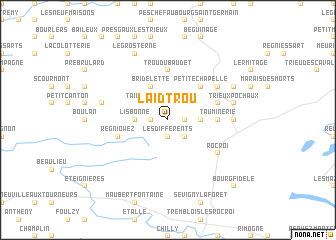
Laid Trou (Namur, Belgium)Laid Trou is a town in the Namur region of Belgium. An overview map of the region around Laid Trou is displayed below.
regional and 3d topo map of Laid Trou, Belgium ::
Laid Trou airports ::
The nearest airport is CRL - Charleroi Brussels South, located 56.6 km north of Laid Trou.
Other airports nearby include RHE - Reims Champagne (77.3 km south west), LGG - Liege (103.4 km north east), BRU - Brussels Natl (Melsbroek) (105.8 km north), LIL - Lille Lesquin (119.5 km north west), Nearby towns ::
La Verte Place (1.2km east) //
Le Gué des Bagniaux (1.2km west) //
Les Différents (1.9km south) //
Les Riesses (2.2km north east) //
Taillette (2.2km south east) //
Les Parsonniers (2.2km north west) //
Cul-des-Sarts (2.2km north west) //
Taille Engelée (2.2km north west) //
Les Chenisses (2.4km east) //
LʼEscaillère (2.4km west) //
Lisbonne (2.4km west) //
Les Parsonniers (3.9km north) //
Bridelette (3.9km north) //
Cramion Fay (4.4km north east) //
Petite-Chapelle (4.4km north east) //
Trou du Baudet (5.6km north) //
Brûly-de-Pesche (5.6km north) //
Tauminerie (3.6km east) //
Brûly (4.0km north east) //
Regniowez (4.0km south west) //
La Forge du Prince (5.2km north east) //
Les Grands Prés Larbert (5.2km north east) //
Rocroi (5.2km south east) //
Gué-dʼHossus (4.8km east) //
Trieux Pochaux (5.1km east) //
Moulin Manteau (5.1km east) //
Hauts Marais (5.1km west) //
Fauchisse (6.0km north east) //
La Prise (6.0km north east) //
[all distances 'as the bird flies' and approximate] 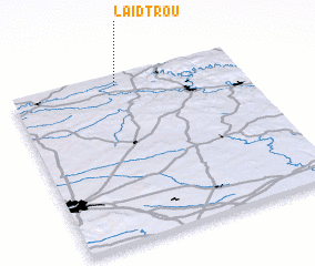 Places with similar names to Laid Trou, Belgium ::
// La Teodora (PA)
// La Auditoría (ES)
// Laditra (MG)
// La Tetera (CL)
// Lauttador (ID)
// Lotuturu (UG)
// Latadar (IR)
// Lateh Darreh (IR)
// Le Tâtre (FR)
// Le Titre (FR)
Disclaimer :: Information on this page comes without warranty of any kind |
||
|
Where is Laid Trou? Elevation and coordinates ::
Latitude (lat): 49°57'0"N Longitude (lon): 4°28'0"E
Elevation (approx.): 334m (map arrows pan, magnifying glasses zoom) |
||
|
Visiting Laid Trou? Hotel/Accommodation ::
Book a hotel in Laid Trou Travel Guide ::
Buy a travel guide for Belgium rental cars ::
car rental offers GPS waypoint ::
download a GPX waypoint (PoI) of Laid Trou for your GPS receiver
|
||