|
search place name
|
||
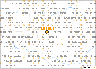
Le Bèle (Namur, Belgium)Le Bèle is a town in the Namur region of Belgium. An overview map of the region around Le Bèle is displayed below.
regional and 3d topo map of Le Bèle, Belgium ::
Le Bèle airports ::
The nearest airport is LGG - Liege, located 50.1 km north east of Le Bèle.
Other airports nearby include CRL - Charleroi Brussels South (50.5 km north west), BRU - Brussels Natl (Melsbroek) (84.0 km north west), MST - Maastricht (88.2 km north east), GKE - Geilenkirchen (104.2 km north east), Nearby towns ::
Chauquenée (0.0km north) //
Conneux (1.2km west) //
Reux (1.2km east) //
Corbion (1.2km east) //
Croix Berck (1.9km south) //
La Brodde (1.9km south) //
Foaranoi (2.2km north west) //
Redia (2.2km south west) //
Gindron (2.2km north west) //
Ronvaux (2.2km south east) //
Barsenalle (2.2km north east) //
Enhet (2.2km south east) //
Crahiat (3.7km north) //
Ychippe (2.4km east) //
Fays (3.9km north) //
Achêne (3.0km north west) //
Petite Trissogne (3.0km south west) //
Le Houisse (3.0km north west) //
Conjoux (3.0km south west) //
Roymont (3.9km south) //
Barcène (3.9km north) //
Chapois (3.0km north east) //
Leignon (3.0km north east) //
Namorimont (3.0km south east) //
Custinne (4.4km south west) //
Trieu de Dinant (4.4km north east) //
Tienne (4.4km north east) //
Pondire (4.4km north east) //
Chevetogne (4.4km south east) //
[all distances 'as the bird flies' and approximate] 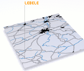 Places with similar names to Le Bèle, Belgium ::
Disclaimer :: Information on this page comes without warranty of any kind |
||
|
Where is Le Bèle? Elevation and coordinates ::
Latitude (lat): 50°15'0"N Longitude (lon): 5°5'0"E
Elevation (approx.): 306m (map arrows pan, magnifying glasses zoom) |
||
|
Visiting Le Bèle? Hotel/Accommodation ::
Book a hotel in Le Bèle Travel Guide ::
Buy a travel guide for Belgium rental cars ::
car rental offers GPS waypoint ::
download a GPX waypoint (PoI) of Le Bèle for your GPS receiver
|
||