|
search place name
|
||
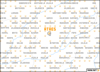
Atães (Braga, Portugal)Atães is a town in the Braga region of Portugal. An overview map of the region around Atães is displayed below.
regional and 3d topo map of Atães, Portugal ::
Atães airports ::
The nearest airport is OPO - Porto, located 42.5 km south west of Atães.
Other airports nearby include VRL - Vila Real (48.4 km south east), VGO - Vigo (92.3 km north), BGC - Braganca (136.3 km east), SCQ - Santiago (161.2 km north), Nearby towns ::
Costeira (1.9km north) //
Corredoura (1.9km north) //
Mesão Frio (1.4km west) //
Cruz da Argola (1.4km west) //
Paçô Vieira (1.9km south) //
Aldão (2.3km north west) //
São Cosme (3.7km north) //
Arões (2.8km east) //
Cachada (4.0km north) //
Rendufe (4.0km north) //
São Torcato (4.0km north) //
Casas Novas (4.0km north) //
Assento (4.0km north) //
Louredo (3.3km north west) //
Espariz (3.3km south west) //
Costa (3.3km south west) //
Cepães (3.3km south east) //
Infantas (4.0km south) //
Fareja (4.0km south) //
Gominhães (4.6km north west) //
Cerca (4.6km north west) //
Listoso (4.6km north east) //
Aldeias (4.6km north west) //
Pinheiro (4.6km south west) //
Bacelos (4.6km south east) //
Gonça (5.6km north) //
Varziela (4.2km east) //
Guimarães (4.2km west) //
Azurém (4.2km west) //
[all distances 'as the bird flies' and approximate] 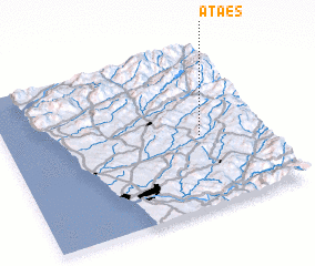 Places with similar names to Atães, Portugal ::
Disclaimer :: Information on this page comes without warranty of any kind |
||
|
Where is Atães? Elevation and coordinates ::
Latitude (lat): 41°27'0"N Longitude (lon): 8°15'0"W
Elevation (approx.): 246m (map arrows pan, magnifying glasses zoom) |
||
|
Visiting Atães? Hotel/Accommodation ::
Book a hotel in Atães Travel Guide ::
Buy a travel guide for Portugal rental cars ::
car rental offers GPS waypoint ::
download a GPX waypoint (PoI) of Atães for your GPS receiver
|
||