|
search place name
|
||
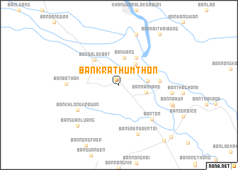
Ban Krathum Thon (Nakhon Sawan, Thailand)Ban Krathum Thon is a town in the Nakhon Sawan region of Thailand. An overview map of the region around Ban Krathum Thon is displayed below.
regional and 3d topo map of Ban Krathum Thon, Thailand ::
Ban Krathum Thon airports ::
The nearest airport is PHS - Phitsanulok, located 102.2 km north east of Ban Krathum Thon.
Other airports nearby include LOE - Loei (258.7 km north east), Nearby towns ::
Ban Pak Khlong (4.1km north east) //
Ban Wang (4.4km north) //
Ban Nam Ham (1) (4.3km east) //
Ban Huai Bai (4.4km east) //
Ban Bang Kaeo (5.1km north east) //
Ban Salok Bat (5.4km north west) //
Ban Daen (6.2km east) //
Ban Ton (7.4km south east) //
Ban Khlong Kradan (7.5km south west) //
Ban Saen Saep Tai (8.3km south) //
Ban Ta Sang (8.1km east) //
Ban Bo Tham (8.0km west) //
Ban Ko (8.4km north) //
Ban Na Hup (8.5km east) //
Ban Khlong Ngaeng (8.8km east) //
Ban Suan Luang (9.0km south west) //
Ban Mai Thai Bung (10.1km north east) //
Ban Tha Raet (11.1km south east) //
Ban Dong Kanghan (11.3km south east) //
[all distances 'as the bird flies' and approximate] 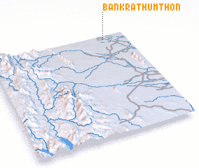 Places with similar names to Ban Krathum Thon, Thailand :: Disclaimer :: Information on this page comes without warranty of any kind |
||
|
Where is Ban Krathum Thon? Elevation and coordinates ::
Latitude (lat): 15°57'40"N Longitude (lon): 99°50'32"E
Elevation (approx.): 46m (map arrows pan, magnifying glasses zoom) |
||
|
Visiting Ban Krathum Thon? Hotel/Accommodation ::
Book a hotel in Ban Krathum Thon Travel Guide ::
Buy a travel guide for Thailand rental cars ::
car rental offers GPS waypoint ::
download a GPX waypoint (PoI) of Ban Krathum Thon for your GPS receiver
|
||