|
search place name
|
||
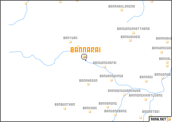
Ban Na Rai (Udon Thani, Thailand)Ban Na Rai is a town in the Udon Thani region of Thailand. An overview map of the region around Ban Na Rai is displayed below.
regional and 3d topo map of Ban Na Rai, Thailand ::
Ban Na Rai airports ::
The nearest airport is VTE - Vientiane Wattay Intl, located 54.4 km north east of Ban Na Rai.
Other airports nearby include LOE - Loei (55.3 km south west), UTH - Udon Thani (69.1 km south east), SNO - Sakon Nakhon (210.3 km east), PHS - Phitsanulok (225.1 km south west), Nearby towns ::
Ban Tha Li (3.5km north west) //
Ban Dong Mafai (4.2km east) //
Ban Pha Son (5.2km south) //
Ban Yuak (5.3km north west) //
Ban Wang Hin Sa (6.8km south east) //
Amphoe Suwan Khu Ha (10.9km south east) //
[all distances 'as the bird flies' and approximate] 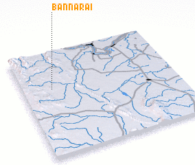 Places with similar names to Ban Na Rai, Thailand ::
Disclaimer :: Information on this page comes without warranty of any kind |
||
|
Where is Ban Na Rai? Elevation and coordinates ::
Latitude (lat): 17°38'44"N Longitude (lon): 102°11'46"E
Elevation (approx.): 220m (map arrows pan, magnifying glasses zoom) |
||
|
Visiting Ban Na Rai? Hotel/Accommodation ::
Book a hotel in Ban Na Rai Travel Guide ::
Buy a travel guide for Thailand rental cars ::
car rental offers GPS waypoint ::
download a GPX waypoint (PoI) of Ban Na Rai for your GPS receiver
|
||