|
search place name
|
||
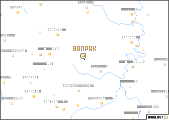
Ban Pak (Nong Khai, Thailand)Ban Pak is a town in the Nong Khai region of Thailand. An overview map of the region around Ban Pak is displayed below.
regional and 3d topo map of Ban Pak, Thailand ::
Ban Pak airports ::
The nearest airport is UTH - Udon Thani, located 73.1 km south west of Ban Pak.
Other airports nearby include VTE - Vientiane Wattay Intl (79.7 km west), SNO - Sakon Nakhon (112.0 km south east), LOE - Loei (172.7 km west), ZVK - Savannakhet (209.9 km south east), Nearby towns ::
Ban Sai Mun (4.2km south east) //
Ban Nong Song Hong (7.0km south) //
Ban Thung Yai (7.6km west) //
Ban Pho Kao (8.0km north west) //
Ban Huai I Do (9.9km south west) //
[all distances 'as the bird flies' and approximate]  Places with similar names to Ban Pak, Thailand ::
// Ban Pak (TH)
// Ban Pak (TH)
// Ban Pa Kae (TH)
// Ban Pa Kao (TH)
// Ban Pa Kao (TH)
// Ban Pa Kia (TH)
// Ban Pak Ka (TH)
// Ban Pak Kiu (TH)
// Ban Pak Ko (TH)
// Ban Pa Ko (TH)
Disclaimer :: Information on this page comes without warranty of any kind |
||
|
Where is Ban Pak? Elevation and coordinates ::
Latitude (lat): 17°49'50"N Longitude (lon): 103°17'51"E
Elevation (approx.): 161m (map arrows pan, magnifying glasses zoom) |
||
|
Visiting Ban Pak? Hotel/Accommodation ::
Book a hotel in Ban Pak Travel Guide ::
Buy a travel guide for Thailand rental cars ::
car rental offers GPS waypoint ::
download a GPX waypoint (PoI) of Ban Pak for your GPS receiver
|
||