|
search place name
|
||
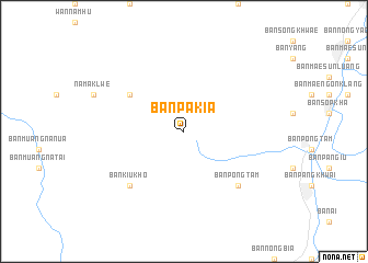
Ban Pa Kia (Chiang Rai, Thailand)Ban Pa Kia is a town in the Chiang Rai region of Thailand. An overview map of the region around Ban Pa Kia is displayed below.
regional and 3d topo map of Ban Pa Kia, Thailand ::
Ban Pa Kia airports ::
The nearest airport is MOG - Mong Hsat, located 86.3 km north of Ban Pa Kia.
Other airports nearby include THL - Tachilek Tachileik (123.3 km north east), LPT - Lampang (172.8 km south), KET - Kengtung (181.2 km north), PRH - Phrae (216.6 km south east), Nearby towns ::
Ban Khom (6.4km north west) //
Ban Luang (6.4km north west) //
Ban Kiu Kho (7.6km south west) //
Ban Pa Ngiu (7.6km south east) //
Ban Pong Tam (7.6km south east) //
[all distances 'as the bird flies' and approximate] 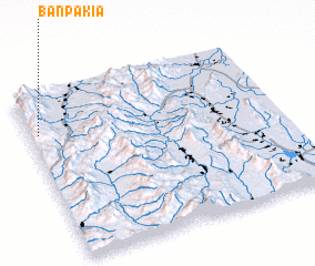 Places with similar names to Ban Pa Kia, Thailand ::
// Ban Pak (TH)
// Ban Pak (TH)
// Ban Pak (TH)
// Ban Pa Kae (TH)
// Ban Pa Kao (TH)
// Ban Pa Kao (TH)
// Ban Pak Ka (TH)
// Ban Pak Kiu (TH)
// Ban Pak Ko (TH)
// Ban Pa Ko (TH)
Disclaimer :: Information on this page comes without warranty of any kind |
||
|
Where is Ban Pa Kia? Elevation and coordinates ::
Latitude (lat): 19°46'0"N Longitude (lon): 99°2'0"E
Elevation (approx.): 1291m (map arrows pan, magnifying glasses zoom) |
||
|
Visiting Ban Pa Kia? Hotel/Accommodation ::
Book a hotel in Ban Pa Kia Travel Guide ::
Buy a travel guide for Thailand rental cars ::
car rental offers GPS waypoint ::
download a GPX waypoint (PoI) of Ban Pa Kia for your GPS receiver
|
||