|
search place name
|
||
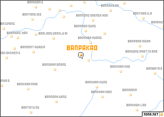
Ban Pa Kao (Udon Thani, Thailand)Ban Pa Kao is a town in the Udon Thani region of Thailand. An overview map of the region around Ban Pa Kao is displayed below.
regional and 3d topo map of Ban Pa Kao, Thailand ::
Ban Pa Kao airports ::
The nearest airport is UTH - Udon Thani, located 54.9 km north west of Ban Pa Kao.
Other airports nearby include SNO - Sakon Nakhon (92.8 km east), VTE - Vientiane Wattay Intl (117.1 km north west), LOE - Loei (165.1 km west), ZVK - Savannakhet (174.4 km east), Nearby towns ::
Ban Huai Yang (1.5km east) //
Ban Kham Muang (4.1km north east) //
Ban Phon Sung (6.3km north) //
Ban Sam Pa Rang (6.4km south west) //
Ban Kham Kung (7.3km south east) //
Ban Nong Waeng Tat (7.6km north east) //
Ban Lao Suan Kluai (7.8km north west) //
Ban Nong Saeng Khok (9.1km north) //
Ban Kham Kho (8.9km east) //
Ban Kham Moei (9.8km south east) //
[all distances 'as the bird flies' and approximate] 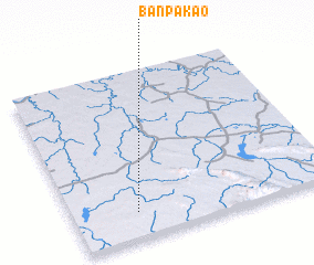 Places with similar names to Ban Pa Kao, Thailand ::
// Ban Pak (TH)
// Ban Pak (TH)
// Ban Pak (TH)
// Ban Pa Kae (TH)
// Ban Pa Kao (TH)
// Ban Pa Kia (TH)
// Ban Pak Ka (TH)
// Ban Pak Kiu (TH)
// Ban Pak Ko (TH)
// Ban Pa Ko (TH)
Disclaimer :: Information on this page comes without warranty of any kind |
||
|
Where is Ban Pa Kao? Elevation and coordinates ::
Latitude (lat): 17°9'30"N Longitude (lon): 103°14'49"E
Elevation (approx.): 214m (map arrows pan, magnifying glasses zoom) |
||
|
Visiting Ban Pa Kao? Hotel/Accommodation ::
Book a hotel in Ban Pa Kao Travel Guide ::
Buy a travel guide for Thailand rental cars ::
car rental offers GPS waypoint ::
download a GPX waypoint (PoI) of Ban Pa Kao for your GPS receiver
|
||