|
search place name
|
||
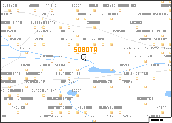
Sobota (Poland)Sobota is a town in Poland. An overview map of the region around Sobota is displayed below.
regional and 3d topo map of Sobota, Poland ::
Sobota airports ::
The nearest airport is WAW - Warsaw Okecie, located 88.1 km east of Sobota.
Other airports nearby include KTW - Katowice Pyrzowice (187.5 km south), Nearby towns ::
Zakrzew (2.2km north west) //
Kościuszki (2.2km north east) //
Walewice (2.2km south west) //
Przezwiska (2.3km west) //
Głuchów (3.9km north) //
Dębowa Góra (3.9km north) //
Marywil (2.9km south west) //
Wewiórz (4.3km north west) //
Bąków Poduchowny (4.3km north east) //
Bielawska Wieś (4.4km south west) //
Antoniew (5.7km north) //
Seligi (3.9km south west) //
Sobocka Wieś (3.9km south east) //
Gaj (5.7km south) //
Bąków Górny (5.0km north east) //
Bąków Dolny (5.0km north east) //
Wilkęsy (6.0km north) //
Bielawy (6.0km south) //
Wojewodza (6.0km south) //
Wola Kałkowa (4.6km west) //
Zosinów (7.5km north) //
Bogoria Dolna (4.9km east) //
Zgoda (7.5km south) //
Piotrowice (6.5km south east) //
Plecka Dąbrowa (7.8km north) //
Chruślin Kościelny (5.9km south east) //
Ernestynów (8.2km north west) //
Kujawki (8.2km north west) //
Janinów (7.2km south west) //
[all distances 'as the bird flies' and approximate] 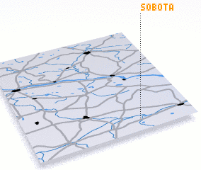 Places with similar names to Sobota, Poland ::
Disclaimer :: Information on this page comes without warranty of any kind |
||
|
Where is Sobota? Elevation and coordinates ::
Latitude (lat): 52°7'0"N Longitude (lon): 19°41'0"E
Elevation (approx.): 96m (map arrows pan, magnifying glasses zoom) |
||
|
Visiting Sobota? Hotel/Accommodation ::
Book a hotel in Sobota Travel Guide ::
Buy a travel guide for Poland rental cars ::
car rental offers GPS waypoint ::
download a GPX waypoint (PoI) of Sobota for your GPS receiver
|
||