|
search place name
|
||
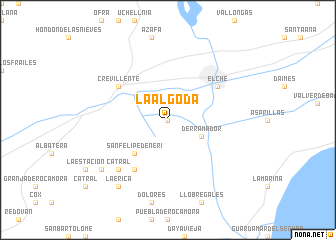
La Algoda (Comunidad Valenciana, Spain)La Algoda is a town in the Comunidad Valenciana region of Spain. An overview map of the region around La Algoda is displayed below.
regional and 3d topo map of La Algoda, Spain ::
La Algoda airports ::
The nearest airport is ALC - Alicante, located 18.3 km north east of La Algoda.
Other airports nearby include MJV - Murcia San Javier (49.3 km south), VLC - Valencia (143.2 km north), LEI - Almeria (209.1 km south west), Nearby towns ::
Matola (0.0km north) //
Derramador (3.5km south east) //
San Felipe de Neri (4.7km south west) //
Santa Águeda (6.3km south west) //
Elche (5.7km north east) //
Crevillente (5.7km north west) //
Catral (7.1km south west) //
Casicas (8.1km south west) //
La Erica (8.6km south west) //
[all distances 'as the bird flies' and approximate]  Places with similar names to La Algoda, Spain ::
// La Algaida (ES)
// Loolo Ekoto (CD)
// Lālāguda (IN)
// Lālgudi (IN)
// Lelkada (LK)
// Lellagoda (LK)
// Lolgoda (LK)
// Loolkade (LK)
// Lāleh Kotī (IR)
// Lel Gat (PK)
Disclaimer :: Information on this page comes without warranty of any kind |
||
|
Where is La Algoda? Elevation and coordinates ::
Latitude (lat): 38°13'0"N Longitude (lon): 0°45'0"W
Elevation (approx.): 17m (map arrows pan, magnifying glasses zoom) |
||
|
Visiting La Algoda? Hotel/Accommodation ::
Book a hotel in La Algoda Travel Guide ::
Buy a travel guide for Spain rental cars ::
car rental offers GPS waypoint ::
download a GPX waypoint (PoI) of La Algoda for your GPS receiver
|
||