|
search place name
|
||
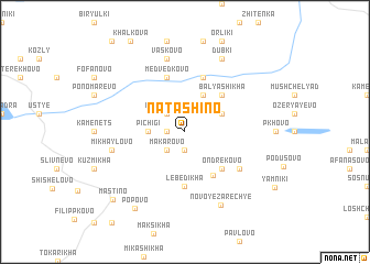
Natashino (Tverskaya Oblast', Russia)Natashino is a town in the Tverskaya Oblast' region of Russia. An overview map of the region around Natashino is displayed below.
regional and 3d topo map of Natashino, Russia ::
Natashino airports ::
The nearest airport is KLD - Tver Migalovo, located 136.0 km south of Natashino.
Nearby towns ::
Deryagino (1.9km south) //
Pogorelka (1.0km west) //
Makarovo (2.1km south west) //
Podsosen'ye (2.1km north west) //
Pichigi (2.0km west) //
Kolodino (2.7km north east) //
Krasukha (3.8km north) //
Bychikha (4.6km south) //
Ondrekovo (4.2km south east) //
Dor (4.2km north east) //
Balyashikha (4.2km north east) //
Lebedikha (5.6km south) //
Medvedkovo (5.6km north) //
Blavskoye (5.6km north) //
Lukotikho (4.7km south east) //
Mikhaylovo (4.3km south west) //
Vas'kovo (7.5km north) //
Novoye Zarech'ye (7.7km south) //
Dubki (7.7km north) //
Popovo (8.2km south) //
Mastino (7.9km south west) //
[all distances 'as the bird flies' and approximate] 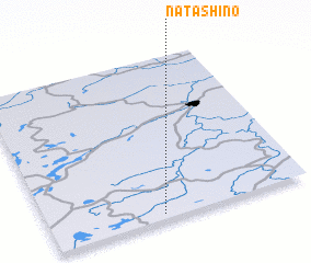 Places with similar names to Natashino, Russia ::
// Natashino (UA)
// Natashino (UA)
// Netishyn (UA)
// Netechino (RU)
// Neudachino (RU)
// Natashino (KZ)
// Ndiatiane (SN)
// Nadūshan (IR)
// Natchino (VU)
// Nitachinai (JP)
Disclaimer :: Information on this page comes without warranty of any kind |
||
|
Where is Natashino? Elevation and coordinates ::
Latitude (lat): 58°2'0"N Longitude (lon): 35°26'0"E
Elevation (approx.): 149m (map arrows pan, magnifying glasses zoom) |
||
|
Visiting Natashino? Hotel/Accommodation ::
Book a hotel in Natashino Travel Guide ::
Buy a travel guide for Russia rental cars ::
car rental offers GPS waypoint ::
download a GPX waypoint (PoI) of Natashino for your GPS receiver
|
||