|
search place name
|
||
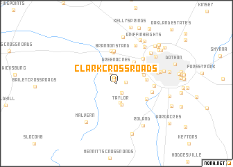
Clark Crossroads (Alabama, United States - USA)Clark Crossroads is a town in the Alabama region of United States - USA. An overview map of the region around Clark Crossroads is displayed below.
regional and 3d topo map of Clark Crossroads, United States - USA ::
Clark Crossroads airports ::
The nearest airport is DHN - Dothan Rgnl, located 14.2 km north of Clark Crossroads.
Other airports nearby include CEW - Crestview Bob Sikes (110.1 km south west), PAM - Panama City Tyndall Afb (125.2 km south), VPS - Valparaiso Eglin Afb (127.7 km south west), LSF - Fort Benning Lawson Aaf (134.7 km north), Nearby towns ::
Peterman (0.6km north west) //
Trawick Road Estates (1.3km east) //
Tabernacle (1.7km south east) //
Jones Crossroads (1.9km north west) //
Green Acres (2.8km north) //
Spann Brothers Estates (3.0km north) //
Parker Village (3.1km south) //
Taylor (3.5km south) //
Pine Ridge Estates (4.2km north east) //
Silver Meadows (4.0km east) //
Springdale (4.2km north east) //
Chickasaw Heights (4.2km east) //
Brannon Stand (5.0km north) //
Whispering Pines (5.2km north) //
Brannon Stand Heights (5.2km north) //
Spring Valley Acres (4.9km south east) //
Ross Heights (5.2km north east) //
Bel Air (5.4km north east) //
Lakewood Estates (5.1km east) //
Barrett (5.2km east) //
Stonebridge Estates (5.5km north east) //
Brentwood (6.6km north east) //
Harwood Heights (6.0km east) //
Chateau Estates (7.0km north east) //
Bell-Merrill (6.4km east) //
Solomon Heights (6.8km north east) //
Peach Tree Hills (7.4km north) //
Lamont Court (6.9km north east) //
Normandale (6.8km east) //
[all distances 'as the bird flies' and approximate] 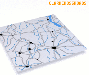 Places with similar names to Clark Crossroads, United States - USA :: Disclaimer :: Information on this page comes without warranty of any kind |
||
|
Where is Clark Crossroads? Elevation and coordinates ::
Latitude (lat): 31°11'43"N Longitude (lon): 85°28'33"W
Elevation (approx.): 91m (map arrows pan, magnifying glasses zoom) |
||
|
Visiting Clark Crossroads? Hotel/Accommodation ::
Book a hotel in Clark Crossroads Travel Guide ::
rental cars ::
car rental offers GPS waypoint ::
download a GPX waypoint (PoI) of Clark Crossroads for your GPS receiver
|
||