|
search place name
|
||
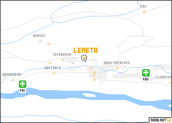
Lemeta (Alaska, United States - USA)Lemeta is a town in the Alaska region of United States - USA. An overview map of the region around Lemeta is displayed below.
regional and 3d topo map of Lemeta, United States - USA ::
Lemeta airports ::
The nearest airport is FBK - Fort Wainwright Ladd Aaf, located 6.1 km south east of Lemeta.
Other airports nearby include FAI - Fairbanks Intl (7.7 km south west), EIL - Fairbanks Eielson Afb (37.0 km south east), Nearby towns ::
Slaterville (1.4km south) //
Aurora (1.3km west) //
Fairbanks (2.6km south) //
South Fairbanks (3.0km south) //
Bjerrmark (3.9km south) //
Totem Park (2.2km west) //
Hamilton Acres (3.2km south east) //
Westgate (3.9km south west) //
College (3.3km west) //
Dogpatch (5.3km north west) //
[all distances 'as the bird flies' and approximate]  Places with similar names to Lemeta, United States - USA ::
Disclaimer :: Information on this page comes without warranty of any kind |
||
|
Where is Lemeta? Elevation and coordinates ::
Latitude (lat): 64°51'35"N Longitude (lon): 147°43'56"W
(map arrows pan, magnifying glasses zoom) |
||
|
Visiting Lemeta? Hotel/Accommodation ::
Book a hotel in Lemeta Travel Guide ::
rental cars ::
car rental offers GPS waypoint ::
download a GPX waypoint (PoI) of Lemeta for your GPS receiver
|
||