|
search place name
|
||
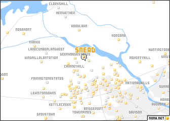
Snead (Georgia, United States - USA)Snead is a town in the Georgia region of United States - USA. An overview map of the region around Snead is displayed below.
regional and 3d topo map of Snead, United States - USA ::
Snead airports ::
The nearest airport is AGS - Bush Field Augusta Rgnl At Bush Fld, located 26.1 km south east of Snead.
Other airports nearby include CAE - Colombia Columbia Metropolitan (101.6 km north east), AND - Andersen Anderson Rgnl (116.5 km north west), SSC - Sumter Shaw Afb (159.4 km east), WRB - Macon Robins Afb (171.4 km south west), Nearby towns ::
Fernbrook (0.7km north) //
Creek View (0.7km east) //
Deerwood Acres (1.6km west) //
Deerwood Estates (1.9km west) //
Shenandoah Woods (2.6km south east) //
Whispering Pine Mobile Home Park (2.6km south west) //
Chimney Hill (3.0km south west) //
Evans Mill (3.4km south) //
Camelot (3.3km south west) //
Country Place (3.3km south west) //
Jamaica Estates (3.6km south) //
Evans (3.7km south) //
Woodbridge (3.2km west) //
Stevens Creek West (3.7km south east) //
Petersburg Station (4.3km south east) //
Shenandoah (4.5km south) //
Briarwood (4.6km south) //
Idylwilde (5.0km south) //
Candlewood Crossing (4.9km south east) //
Forest Creek (4.5km south east) //
Bonaire Heights (5.1km south) //
Holiday Park (5.4km south) //
Sweetbriar (5.4km south) //
Evanston (5.2km south west) //
Casa Bella (5.5km south) //
Jushua Tree Villas (5.2km south east) //
Westport (4.9km east) //
Glennwood (5.7km south west) //
Woodland (5.9km south) //
[all distances 'as the bird flies' and approximate]  Places with similar names to Snead, United States - USA ::
Disclaimer :: Information on this page comes without warranty of any kind |
||
|
Where is Snead? Elevation and coordinates ::
Latitude (lat): 33°33'56"N Longitude (lon): 82°7'15"W
Elevation (approx.): 111m (map arrows pan, magnifying glasses zoom) |
||
|
Visiting Snead? Hotel/Accommodation ::
Book a hotel in Snead Travel Guide ::
rental cars ::
car rental offers GPS waypoint ::
download a GPX waypoint (PoI) of Snead for your GPS receiver
|
||