|
search place name
|
||
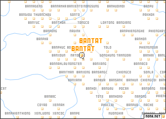
Bản Tát (Sơn La, Vietnam)Bản Tát is a town in the Sơn La region of Vietnam. An overview map of the region around Bản Tát is displayed below.
regional and 3d topo map of Bản Tát, Vietnam ::
Bản Tát airports ::
The nearest airport is LPQ - Luang Prabang Luang Phabang Intl, located 232.1 km south west of Bản Tát.
Nearby towns ::
Bản Chan (0.0km north) //
Nam Tiến (1.7km east) //
Bản Bôn (1) (1.9km north) //
Bản Na Ten (1.9km south) //
Bản Ðẩy (1.7km west) //
NàTói (1.7km west) //
Nong Ỏ (2.5km north east) //
Bản Tát (2.5km north east) //
Bản Lay (2) (2.5km north west) //
Bon Phặng (2.5km north west) //
Nong Ten (2.5km south west) //
Bản Pái (2.5km south west) //
Bản Phặng (3.7km north) //
Bắc Cường (3.7km north) //
Bản Na Khê (3.7km south) //
Bản Xeng (3.7km south) //
Bản Lòng Lo (3.5km west) //
Ba Na Tong (3.5km west) //
Bản Co Phu (4.1km north east) //
Bản Quang (3.9km south east) //
Bản Xàng (3.9km south east) //
Bản Khoang (4.1km north west) //
Bản Na Pái (4.1km south west) //
Bản Tang (3.9km north west) //
Bản Na It (3.9km north west) //
Bản Muội Nội (5.1km south east) //
Bản Sang (2) (5.1km south east) //
Bản It Man (5.1km south west) //
Bản Ba Hê (5.1km south west) //
[all distances 'as the bird flies' and approximate] 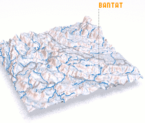 Places with similar names to Bản Tát, Vietnam ::
Disclaimer :: Information on this page comes without warranty of any kind |
||
|
Where is Bản Tát? Elevation and coordinates ::
Latitude (lat): 21°21'0"N Longitude (lon): 103°46'0"E
Elevation (approx.): 995m (map arrows pan, magnifying glasses zoom) |
||
|
Visiting Bản Tát? Hotel/Accommodation ::
Book a hotel in Bản Tát Travel Guide ::
Buy a travel guide for Vietnam rental cars ::
car rental offers GPS waypoint ::
download a GPX waypoint (PoI) of Bản Tát for your GPS receiver
|
||