|
search place name
|
||
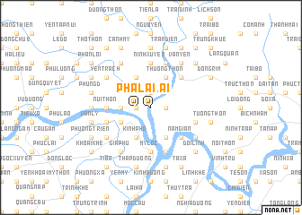
Phả Lại (Hải Hưng, Vietnam)Phả Lại is a town in the Hải Hưng region of Vietnam. An overview map of the region around Phả Lại is displayed below.
regional and 3d topo map of Phả Lại, Vietnam ::
Phả Lại airports ::
The nearest airport is HAN - Hanoi Noibai Intl, located 52.5 km west of Phả Lại.
Other airports nearby include NNG - Nanning Wuxu (254.4 km north east), Nearby towns ::
Trại Mạ (1.9km north) //
Phú Ða (1.7km west) //
Hòa Lac Phố (1.7km east) //
Phả Lại (1.7km west) //
Thinh Lai (3.5km west) //
Ðại Thán (3.9km south west) //
Ba Dương (3.9km south west) //
Thượng Thôn (4.1km north east) //
Thinh Ðông (4.1km north west) //
Kính Phô (4.1km south west) //
Lý Dưởng (4.1km south east) //
Dược Son Làng Bạc (5.1km north east) //
Kỳ Ðặc (5.1km south east) //
Nam Gián (5.1km south east) //
Núi Thôn (5.2km west) //
Mỹ Lộc (5.6km south) //
Bằng Lương (5.6km north) //
Ninh Xuyên (5.6km north) //
Hữu Lộc (5.5km east) //
Cao Chu (5.5km west) //
Chí Linh (5.8km south) //
Bang Lương (5.8km north) //
Yén Trach (6.4km north west) //
Bến Thôn (6.4km north west) //
Khánh Am (6.5km north west) //
Gia Phú (6.5km south west) //
Ðương Mại (6.5km north west) //
Vạn Yên (6.5km north east) //
Phương Son (6.5km north east) //
[all distances 'as the bird flies' and approximate] 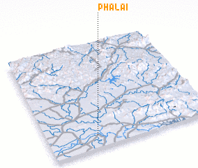 Places with similar names to Phả Lại, Vietnam ::
Disclaimer :: Information on this page comes without warranty of any kind |
||
|
Where is Phả Lại? Elevation and coordinates ::
Latitude (lat): 21°7'0"N Longitude (lon): 106°18'0"E
Elevation (approx.): 9m (map arrows pan, magnifying glasses zoom) |
||
|
Visiting Phả Lại? Hotel/Accommodation ::
Book a hotel in Phả Lại Travel Guide ::
Buy a travel guide for Vietnam rental cars ::
car rental offers GPS waypoint ::
download a GPX waypoint (PoI) of Phả Lại for your GPS receiver
|
||