|
search place name
|
||
Phong Thạnh (Bạc Liêu, Vietnam)Phong Thạnh is a town in the Bạc Liêu region of Vietnam. An overview map of the region around Phong Thạnh is displayed below.
regional and 3d topo map of Phong Thạnh, Vietnam ::

Phong Thạnh airports ::
The nearest airport is SGN - Ho Chi Minh City Tansonnhat Intl, located 214.9 km north east of Phong Thạnh.
Nearby towns ::
Ấp Ðồng Miễu I (2.3km west) //
Xóm Ba Ðình (3.1km north east) //
Ấp Ut Thượng (3.4km east) //
Ấp Kinh Ngang (3.7km south) //
Ấp Tăng Hem (3.9km north west) //
Giá Rai (4.6km south) //
Ấp Nọc Nạn (I) (5.2km west) //
Ấp Kim Xĩa (2) (5.4km north) //
Ấp Xã Tỷ (6.0km east) //
Ấp Kim Xĩa (1) (6.4km north) //
Ấp Rạch Rắn (6.6km south) //
Ấp Thạnh Tr (6.7km south) //
Ấp Bầu Cá Một (6.7km north west) //
Ấp Láng Tròn (6.7km south east) //
Xóm Lo Be (6.8km south west) //
Ấp Hô Phòng (7.3km south west) //
Ấp Cây Gian (7.7km south east) //
Ấp Vình Huệ Mội (8.3km north) //
Xóm Tây Sắc (8.7km south west) //
Xóm Phu Ke (8.8km south) //
Ấp Gia Tuốch (9.1km north east) //
Ấp Ðầu Lá (9.8km south west) //
Long Ðiền (2) (9.8km south west) //
Ấp Ranh Hạt (9.8km north west) //
Ấp Ngân Ðiền (9.9km south east) //
Xóm Giồng Tra (12.2km south east) //
[all distances 'as the bird flies' and approximate] 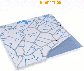 Places with similar names to Phong Thạnh, Vietnam ::
Disclaimer :: Information on this page comes without warranty of any kind |
||
|
Where is Phong Thạnh? Elevation and coordinates ::
Latitude (lat): 9°16'33"N Longitude (lon): 105°27'40"E
Elevation (approx.): 1m (map arrows pan, magnifying glasses zoom) |
||
|
Visiting Phong Thạnh? Hotel/Accommodation ::
Book a hotel in Phong Thạnh Travel Guide ::
Buy a travel guide for Vietnam rental cars ::
car rental offers GPS waypoint ::
download a GPX waypoint (PoI) of Phong Thạnh for your GPS receiver
|
||