|
search place name
|
||
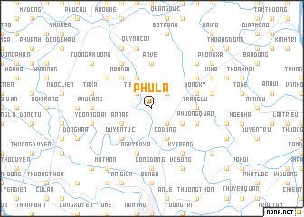
Phú La (Thái Bình, Vietnam)Phú La is a town in the Thái Bình region of Vietnam. An overview map of the region around Phú La is displayed below.
regional and 3d topo map of Phú La, Vietnam ::
Phú La airports ::
The nearest airport is HAN - Hanoi Noibai Intl, located 89.0 km north west of Phú La.
Nearby towns ::
Tien Cần (2.5km north west) //
Cỏ Tiết (2.5km north east) //
Phu Lưu (2.5km south east) //
Mỹ Giá (4.1km north west) //
An Nạp (3.9km south west) //
An Lạc (3.9km south west) //
Cổ Dũng (4.1km south east) //
Ðào Xá (3.9km south east) //
Nam Ðai (5.1km north west) //
Duyên Tục (5.1km south west) //
An Vệ (5.6km north) //
Tràng Lu (5.2km east) //
Nguyên Xá (5.8km south) //
Lũ Phong (5.8km south) //
Ðồng Kỷ (5.5km east) //
Phương Quan (5.5km east) //
Mỹ Ngọc (6.6km north west) //
Khả Lang (6.4km north west) //
Kỳ Trọng (6.6km south east) //
Giới Phúc (6.4km north east) //
Phú Lãng (6.9km west) //
Dông Dộng (7.4km south) //
Quỳnh Ngọc (7.6km north) //
Quỳnh Côi (7.6km north) //
Ta Xá (7.2km west) //
An Duc (7.2km east) //
Y Ðốn Ngoai (7.2km west) //
Lài Ôn (7.6km north east) //
Lương Cụ (8.2km north west) //
[all distances 'as the bird flies' and approximate] 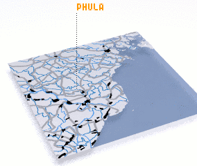 Places with similar names to Phú La, Vietnam ::
Disclaimer :: Information on this page comes without warranty of any kind |
||
|
Where is Phú La? Elevation and coordinates ::
Latitude (lat): 20°36'0"N Longitude (lon): 106°21'0"E
Elevation (approx.): 3m (map arrows pan, magnifying glasses zoom) |
||
|
Visiting Phú La? Hotel/Accommodation ::
Book a hotel in Phú La Travel Guide ::
Buy a travel guide for Vietnam rental cars ::
car rental offers GPS waypoint ::
download a GPX waypoint (PoI) of Phú La for your GPS receiver
|
||