|
search place name
|
||
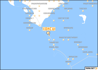
Xóm Củi (Kiến Giang, Vietnam)Xóm Củi is a town in the Kiến Giang region of Vietnam. An overview map of the region around Xóm Củi is displayed below.
regional and 3d topo map of Xóm Củi, Vietnam ::
Xóm Củi airports ::
The nearest airport is PNH - Phnom-penh Phnom Penh Intl, located 137.1 km north of Xóm Củi.
Nearby towns ::
Ấp Rạch Núi (0.0km north) //
Ấp Hòa Phầu (1.9km south) //
Ấp Soa Ảo (2.6km south east) //
Ấp Ngã Tư (2.6km north east) //
Xóm Eo (2.6km north west) //
Thuân Yên (4.1km south east) //
Hà Tiên (5.2km north west) //
Phum Lœu (5.9km south) //
Ấp Hòn Heo (5.9km south) //
Xóm Láng Tranh (5.9km north) //
Ấp An Tín (5.8km east) //
Xóm Vàm Hàng (7.4km north) //
Ấp Àn Dũng (7.5km east) //
Phum Totưng Thngay (7.5km east) //
Xóm Bãi Dấu (7.5km west) //
Xóm Dứa (7.5km west) //
Xóm Tiệt Côn (7.8km north east) //
Xóm Hoành Táu (8.2km north west) //
Núi Thạch Ðông (8.3km north west) //
Xóm Xa Kỳ (9.2km north west) //
Xóm Bà Lý (9.2km north west) //
Xóm Xa Xía (10.4km north west) //
[all distances 'as the bird flies' and approximate] 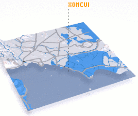 Places with similar names to Xóm Củi, Vietnam ::
Disclaimer :: Information on this page comes without warranty of any kind |
||
|
Where is Xóm Củi? Elevation and coordinates ::
Latitude (lat): 10°21'0"N Longitude (lon): 104°31'0"E
Elevation (approx.): 63m (map arrows pan, magnifying glasses zoom) |
||
|
Visiting Xóm Củi? Hotel/Accommodation ::
Book a hotel in Xóm Củi Travel Guide ::
Buy a travel guide for Vietnam rental cars ::
car rental offers GPS waypoint ::
download a GPX waypoint (PoI) of Xóm Củi for your GPS receiver
|
||