|
search place name
|
||
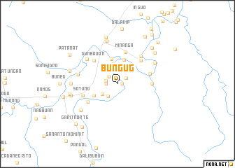
Bungug (Isabela, Philippines)Bungug is a town in the Isabela region of Philippines. An overview map of the region around Bungug is displayed below.
regional and 3d topo map of Bungug, Philippines ::
Bungug airports ::
The nearest airport is BAG - Baguio, located 123.0 km west of Bungug.
Nearby towns ::
Annatunan (0.7km east) //
Calacaab (1.6km north east) //
Sinabbaran (1.7km north west) //
Carulay (1.8km west) //
San Antonio (1.9km west) //
Dalenat (2.0km north) //
Dugayung (2.4km south west) //
Tuguegarao (2.9km south west) //
Alinguigan (3.3km north) //
Bantug (3.4km north east) //
Aniog (4.0km north) //
Barancuag (4.1km north) //
Gucab (4.0km south west) //
Canangan (5.1km north east) //
Baniquet (5.1km north east) //
Baui (5.1km north east) //
San Jose (5.1km north east) //
Calabayan (5.1km north east) //
Calabayan-Minanga (5.1km north east) //
San Francisco (5.1km north east) //
Pappat (5.1km north east) //
Dipaluda (5.1km north east) //
Duroc (5.1km north east) //
Esperanza (5.1km north east) //
Layus (5.1km north east) //
Kalusutan (5.1km north east) //
Gumbauan (5.1km north west) //
Minanga (5.3km north) //
Macalauat (5.2km east) //
[all distances 'as the bird flies' and approximate] 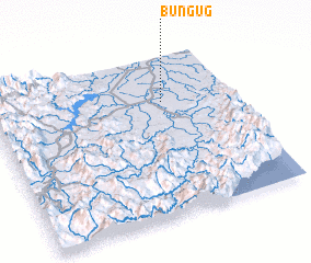 Places with similar names to Bungug, Philippines ::
Disclaimer :: Information on this page comes without warranty of any kind |
||
|
Where is Bungug? Elevation and coordinates ::
Latitude (lat): 16°43'0"N Longitude (lon): 121°43'0"E
Elevation (approx.): 63m (map arrows pan, magnifying glasses zoom) |
||
|
Visiting Bungug? Hotel/Accommodation ::
Book a hotel in Bungug Travel Guide ::
Buy a travel guide for Philippines rental cars ::
car rental offers GPS waypoint ::
download a GPX waypoint (PoI) of Bungug for your GPS receiver
|
||